Footprints Across Scotland
Why not make a few of your own!
20th to 27th October 2007
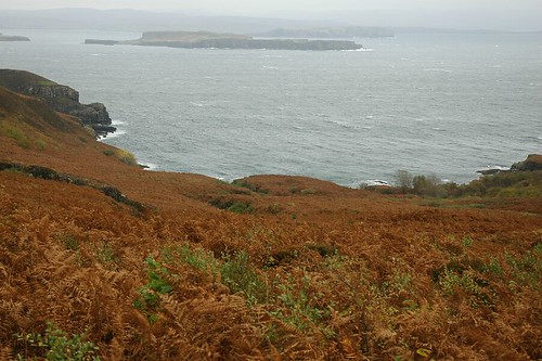
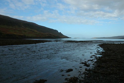
SaturdayStephan and I started the long trip over to Skye from Aberdeen at eight heading up to Inverness and then down along Loch Ness and into Drumnadrochit were we stopped for coffee and a Croissant. Continuing down Loch Ness until reaching Inver Moriston and then headed out west and into Glen Shiel and through to Kyle of Lochalsh. Finally over the bridge to Skye which doesn't sound quite as exciting as over the sea to Skye but it's around this point when you start to get a feeling of how special the place is. We had good views of the hills around Broadford and fainter views of the Cullin Mountains in the distance with the tops covered in mist. Skye was again living up to its name as the "misty isle". The road to our lodgings for the week took us up through Sligachan and on towards Dunvegan. We were staying at Orbost House and first impressions were a bit underwhelming, the place looked a little run down to say the least. However after meeting George the owner we were lead up to the rear of the house to the regally named Macleod apartment which turned out to be very comfortable indeed. The living room had good views down toward the sea with the Cullins forming a dramatic backdrop (apparently, although we did not see all week). After unloading the car we had a quick saunter down from the house to the shoreline of Loch Bharcasaig which leads out to Loch Bracadale and the sea.
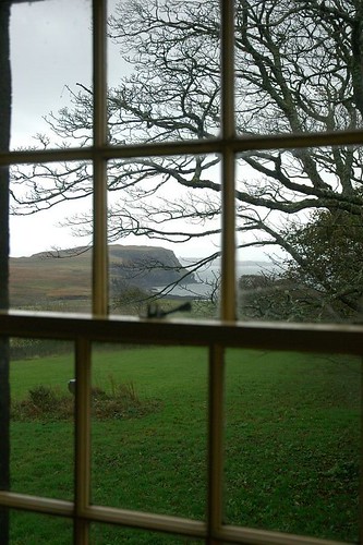
View Down To Loch Bharcasaig
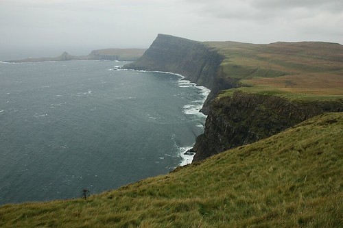
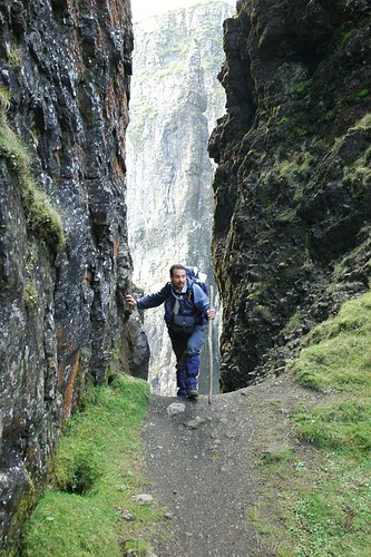
SundayFrom Orbost we followed the road round the Duirinish peninsular through Glendale to the road end at Ramasaig. It was a very grey and very blustery as forecast but we were hopeful that we would escape the rain predicted for the end of the day. From the solitary cottage at Ramasaig We followed the farm track south until gaining its highest point and before it started to descend toward Lorgill. From here we headed off across the boggy hillside toward the Hoe the first of three high points on our intended coastal walk. Reaching the summit plateau of the Hoe we got a true feel for the force of the wind, fortunately it would be partly on our backs for most of the route. Following the plateau edge we found firmer footing on short grass kindly mowed by numerous sheep. A small pool of water gave further evidence of the windy conditioning periodically sending sheets of spray into the air.
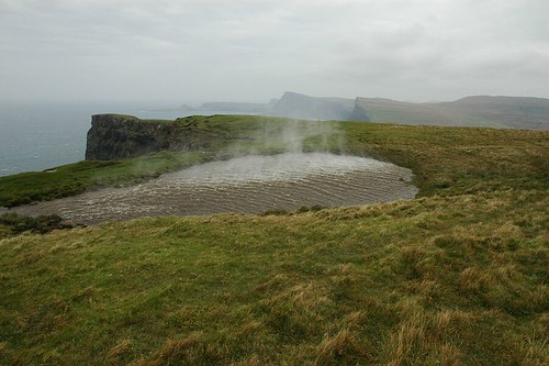
Wind Whipping Up Water On Top Of the Hoe
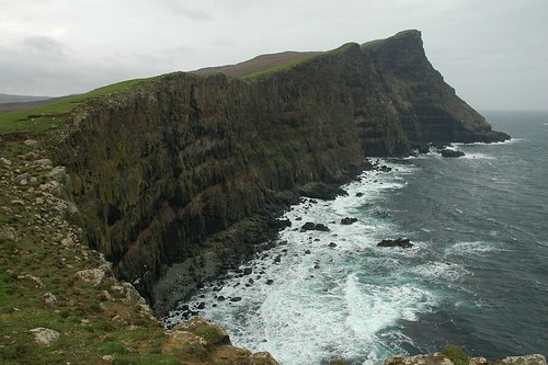
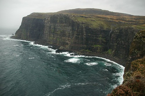
The cliffs all along the coast plummeted dramatically down into the Atlantic Ocean, in places the drop must have been almost a thousand feet. The misty day added to the atmosphere but took a bit away from the views. It was pleasant walking as we followed the cliff edge hugging the coast line as we went. Looking back along the rugged sea cliffs there was a dramatic vista back up to the Hoe.
Looking Back At the Hoe
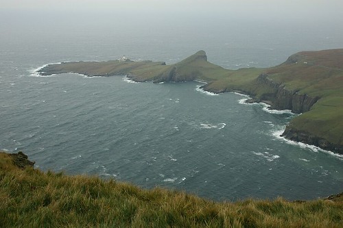
Reaching the bay area we surveyed our route ahead. Ramasaig Cliff would be our next climb, increasing in steepness towards its top.
Ramsaig Cliff
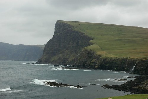
After dropping a short way down the other side we found a sheltered place for a quick snack before continuing on to the highest part of the walk, Waterstein head.
Waterstein Head and Neist Point from Ramsaig Cliff
We had our lunch here enjoying the views down to Neist point and its lighthouse below. A 2k walk back across the moor saw us back on the road to Ramasaig and the final half hour back to the car.
Neist point
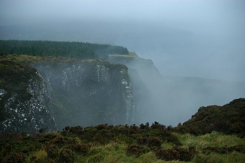
MondayNot expecting a particularly dry day it was decided to have a lazy start. A bit of a lay in was followed by a plenty of tea a hearty breakfast of kippers. (These were Manx kippers and although good not quite as good as the Mallaig kippers I'd enjoyed earlier in the year). The stormy winds continued from Sunday but the rain was only periodic so we made our way out with a couple of options in mind. Skye is made up of many promontories, up in the north west of the Island these rocky fingers of land point out into the Atlantic. We headed off to the Waternish peninsula by way of Dunvegan and Fairy Bridge, then taking the road north to its end we arrived at Trumpan. We parked just as the rain came down and swept across the heather moor land that leads out to one possible destination for the day, Waternish point. After time spent listening to the radio we decided that the showers looked likely to continue and so opted for a short walk around Waternish forest. This would hopefully provide at least partial shelter from the elements if required. It remained dry as we circumnavigated part of the forest before heading part way through it and across open countryside before regaining the tree line for a while and then cutting along a path through a fire break and onto the rocky cliff top of Beinn an Sgurr.
On Top Of Beinn an Sgurr
The forest edge came within a few feet of the cliff edge but the path skirted around the cliff top quite nicely. The rain and mist was adding to the drama of the airy situation and gave an enjoyable if damp tail end to the walk.
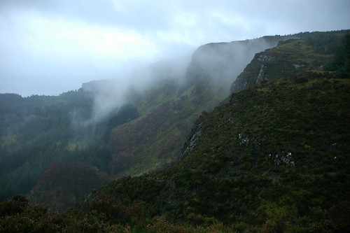
Misty Cliffs of Beinn an Sgurr
TuesdayA lazy start followed by a big breakfast, Groundhog Day? No Tuesday. We headed out of the house around 12 o'clock heading back down and around the bay of Loch Bharcasaig then onto a good path following the headland south along the sea Loch Bracadale. The path passed through trees and up onto Beinn na Moine before starting to drop into a natural amphitheatre above Brandersaig Bay.
Brandersaig Bay
It was here we entered a new plantation named rebel wood created in the memory of Joe Strummer, Clash guitarist and punk legend who was instrumental in setting up the Future forest organization.
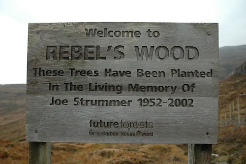
Entrance To Rebel's Wood
Later we passed through the ruins of Idrigill village. Just on from here a slight detour onto to the lower slopes of Ard Beag provided good views down to two natural archers and a number of caves in the sea cliffs.
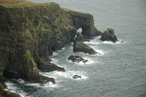
Natural Arch
A short while later we reached our main objective Idrigill point and view's down to Macleod's maidens. The three sea stacks are positioned just a short way from the cliff edge. The tallest stack known as the mother, towers over the two smaller stacks, her two daughters.
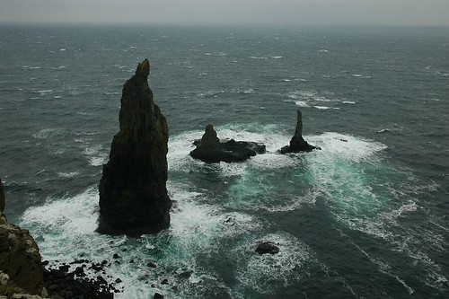
Macleod's maidens
Beyond The Maidens, Inbhir a' Gharraidh
WednesdayToday we would dine out at (or should that be on) Macleod's tables. It would be a little bit of a trek and the dining would be al fresco and a case of bring your own food and drink. Not far from Orbost and Dunvegan are the twin flat summits of Healabhal Bheag and Healabhal Mhor, which appear to have had their tops cut off.
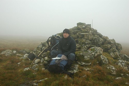
Many years ago a clan chief decided to show his friends that he had what it takes to throw a dinner party with a difference. The Macleod chief held a feast on a starry night with his clansmen holding flaming torches surrounding his party while they ate on top of Healabhal Bheag, hence the new name for the hills, Macleod's tables. From the house we walked back up the road toward Dunvegan and then cut off west across the moor toward Healabhal Mhor. It was boggy going and the well known west coast walkers affliction was truly setting in. "Squelch foot" was only affecting the outside of my boots but was threatening to get inside after a few days wet going. The wind hadn't let up and the mist remained covering the top so we had a quick snack and then headed off to find the next top.
Sheltering Behind The Cairn On Macleod's Table North
Fortunately the mist cleared somewhat before we reached the second summit so we had good, if hazy, views down to the sea.
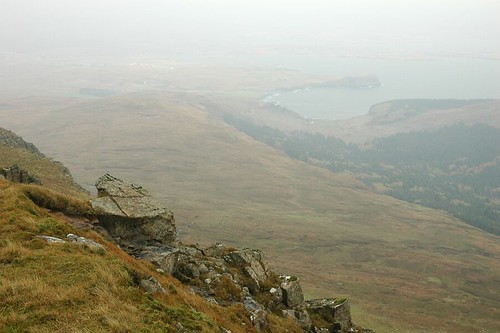
Loch Bharcasaig From Healabhal Bheag
A stone wind break not far from the trig point provided a good spot to eat our lunch. After tea it was then just a case of following the north ridge back down to Orbost and onto the road within a short distance of the house.
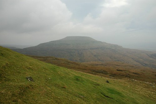
Healabhal Mhor From The Slopes Of Healabhal Bheag
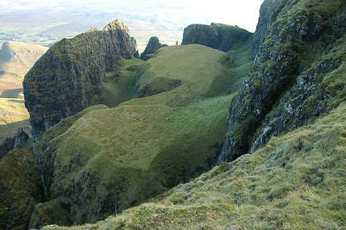
ThursdayAt last a sunny day, the wind was still with us but at least we had plenty of blue sky. We set off to the North end of the Trotternish Peninsula for a visit to the Quiraing; a rocky promontory of many spires, pinnacles and rock towers.
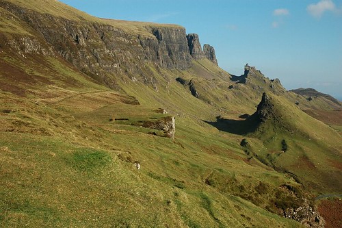
The Quiraing Viewed From Near The Car Park
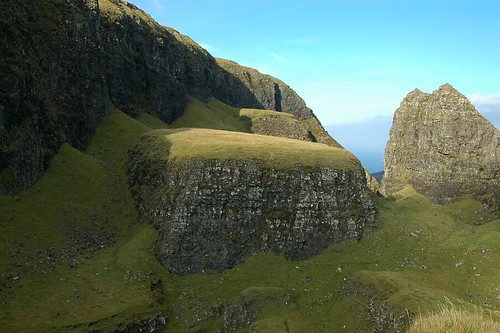
The car park for the walk is at the top of the pass between Uig and Staffin and a fairly level path meanders easily along the bottom of the cliffs and into the centre of the Quiraing. The path then slopes upward between a fort like rocky structure called the Prison on the right and the thin pillar of rock called the needle on the left.
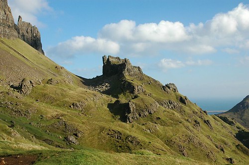
The Prison
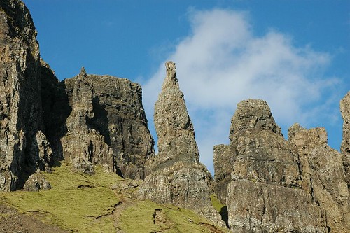
The Needle
We scrambled up steep slopes to the left and then round the back of the needle to enter the heart of the Quiraing, battered by the wind as we climbed. Soon after passing between two large rock pillars we entered an area surrounded on all sides by rocky escarpments and pinnacles. Climbing higher through the labyrinth of passage ways we eventually came upon the flat expanse of grass known as the table, sitting just below the rocky cliffs of Meall na Suirmach. Locals have reputedly in the past taken the trouble to climb up and play shinty on this large grassy area.
The Table
Sherpa Mennaai Inside The Quiraing
After a little exploring we dropped steeply down to the main path and continued along till we reached a fairly low point in the cliffs. After lunch we traveled back over the top of the cliffs and to the summit of Meall na Suiramach with expansive views out to sea and the distant Minches to the north. Near the highest point near the cliff edge there was a good vantage point to view the table from above. Continuing over Maoladh moor we were soon back at our starting point and the car.
The Table From Meall na Suiramach
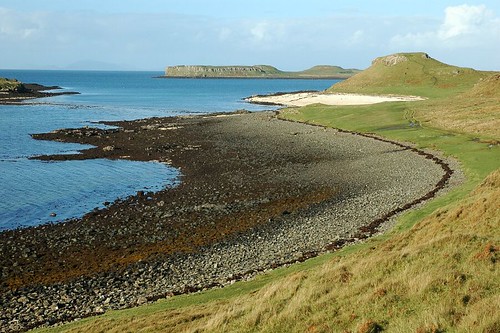
FridayA rainy, blustery night and morning eventually gave way to a calm sunny afternoon. We drove through Dunvegan and Fairy bridge to the upper shores of Loch Bay. Planning a walk around the coast to Lovaig bay and then on to the coral beech just north of Claigan. We headed down a grassy lane and across a meadow to reach a cairn and the suggested crossing point for the river. There was no suggestion in the guide book that this may be a problem but as it turned out it was just about an impossibility. With all the rain the river had become swollen and very fast flowing. We headed down to the bay hoping to find a way across when the river were it joined the beech but after a while decided against it.
Beach at Loch Bay
Wading across in bare feet might have been a possibility but didn't appeal very much and may have been a bit dangerous. The water was churning up dark brown so we were a bit unsure exactly how deep it was. Plan B was then put into action; we returned to the car and drove back around the coast through Dunvegan to Claigan. From here it was a relatively short walk up to the coral beech.
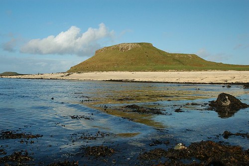
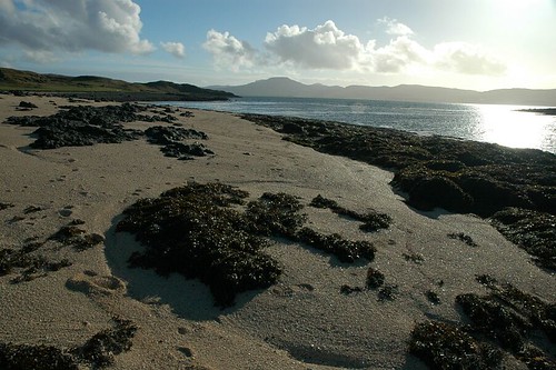
First View Of The Coral Beach
It is a really lovely spot and felt a bit more like a pacific island coastline rather than a corner of Skye. It was really nice to enjoy the sunshine and a bit of a wander around.
Coral Beach
Macleod's Tables From The Beach
We also had a little stroll around to Loviag bay but its stony beech didn't quite compare with the coral beech. The fine white shale on the beech is not true coral but apparently made up of many millions of skeletons of red alga that have been bleached white by the sun. It is pretty special though no matter what the white "sands" are made of.

Islands From Loviag Bay
SaturdayThe drive back to Aberdeen, especially off Skye, was a very wet and very windy affair. The car took a fair buffeting especially going through Glen Sligachan. The waterfalls coming down off the hills were in full flow and very spectacular. We had another stop at Drumnadrochit this time for home made soup and a coffee. A leisurely drive back to Aberdeen saw the end of the holiday arrive all too soon.
Top Of Pagesite info
© 2007-2008 Paul Sammonds. Template Design by Andreas Viklund.