Footprints Across Scotland
Why not make a few of your own!
25th to 27th May 2015
A grand tour of the Monadhliath Mountains.
Route Map
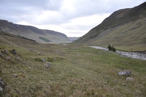
I was long overdue a visit to the Monadhliath, my previous couple of visits had been some time back and only really touched the southern edge of the range. I had made tentative route plans on a couple of occasions so after a quick review formulated a plan for a 3-4 day backpack. Its amazing how easy it is to map out a proposed route, a simple case of joining the points of interest. I had three main tops that I wanted to visit forming a rough triangle, I just needed to join the dots! Finished, I sat back and took a look at the proposed route and opened up the statistics page, all of a sudden Im thinking that this is a bit ambitious, especially when I started to take into account what I was expecting underfoot in the Monadhliath. The ground would almost certainly be very soggy after the recent wet weather which would only add to what is well known to be very difficult terrain. Still the beauty of a backpack is the ability to be flexible and adapt as the journey progresses. The weather forecast was reasonable for Monday through Wednesday but things were due to turn sour on the Thursday. After parking at the Spey Dam I shouldered my pack and headed up Glen Markie enjoying the views across to Creag Meagaidh.
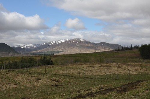
Creag Meagaidh from Spey Dam
Beinn Sgiath the southern top of Geal Charn came into view above the conifer plantation across the Glen.
Geal Charn from Glen Markie
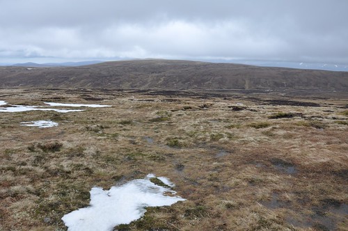
I was going to continue further up the Glen to use the bridge and follow the ridge over Bruach nam Biodag but there looked to be am ATV track following the Pipers burn into the Geal Charns eastern corrie. I just about managed to hop across the burn dry-shod using my walking poles to balance but shouldnt have worried too much as Id have wet feet soon enough. The track was pretty boggy but lead onto a feint path after a gate.
Pipers Burn
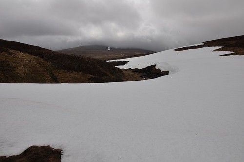
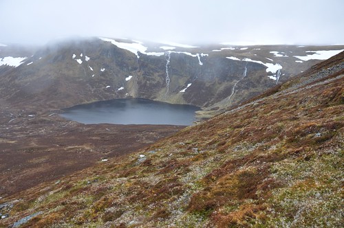
The path followed the burn deep into the corrie from where I climbed up onto the ridge line. There was plenty of snow banks about but there was a soft top to then allowing sure footing. The corrie rim was still corniced although these were breaking up and beginning their inevitable slow slide off the mountain and into Lochan a Choire.
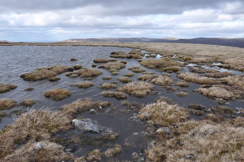
Lochan a' Choire, Geal Charn
The Creag Meagaidth range came back into view as I attained the flattish summit area.
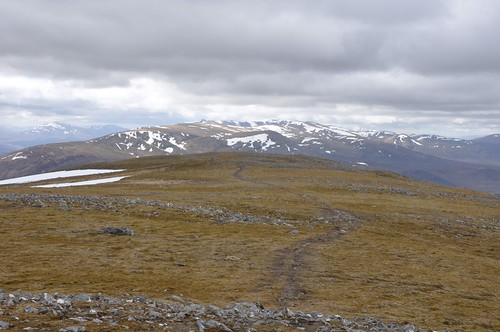
Creag Meagaidh from Geal Charn
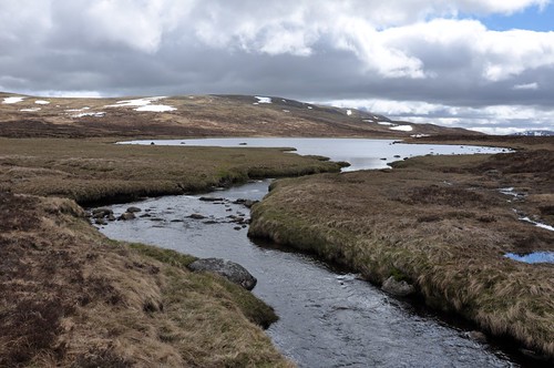
The strong cool breeze didnt encourage any length of stop so I was soon on my way in the direction of Loch na Lairige.

Loch na Lairige
The surrounds of the Lochan offer up some potentially good places to camp but was pretty water logged as I passed through.
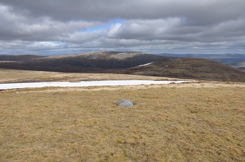
Geal Charn & Loch na Lairige
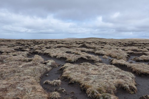
Heading around to the north of Carn Fraoich I struggled over heather and peat hags to reach Dearg Lochan before turning for Creag an Dearg Lochain.
Creag an Dearg Lochain
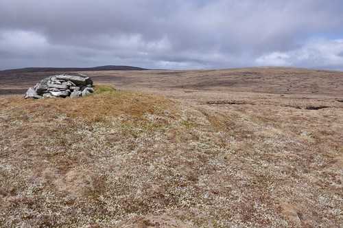
Better ground followed as I worked over to the grassy top of Meall na h-Aisre.
Meall na h-Aisre
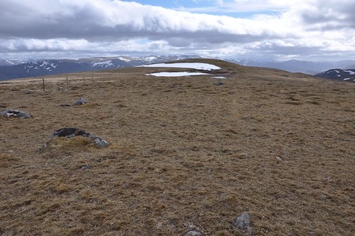
A bit of shelter from the wind allowed a longer stop here with views back over to Geal Charn.
Geal Charn from Meall na h-Aisre
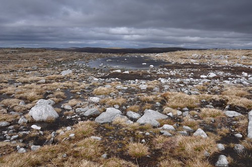
After retracing my steps to the NE top I turned down the ridge toward to Lochan Carn na Gourach.
Lochan, Carn na Gourach
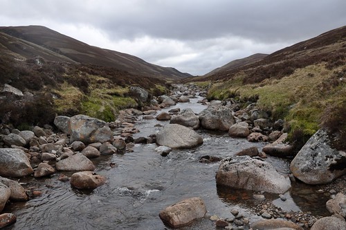
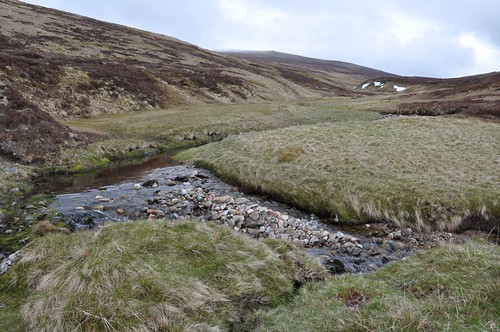
Further down I crossed over one of the bulldozed access tracks that unfortunately scar parts of the Monadhliath. Keeping to the grassy edge of a burn I followed the waters down to a small dam on Allt na Craidhleig. A water vole made quite a splash as it flipped tail to dive below the surface of a pool. The banks of the river continued to provide good going as it turned into Allt Odhar, the Blue grey boulders lying along its bed providing quite a contrast to the steep grassy sides of the developing gorge.
Allt Odhar
The gorge forced me up the hillside a little before I made a return at the bridge where Allt a Choire Odhair joined the flow. From here I used the track that had appeared at the bridge to make my way down to the sorry looking ruins of Stronelairg Lodge.
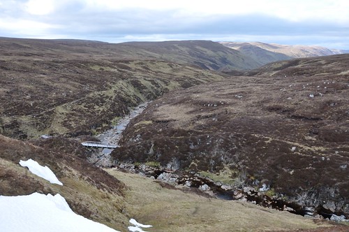
Bridge over Allt Odhar
A couple of bridges near the lodge allowed crossing of the River Killin and then the Glenmarkie burn.
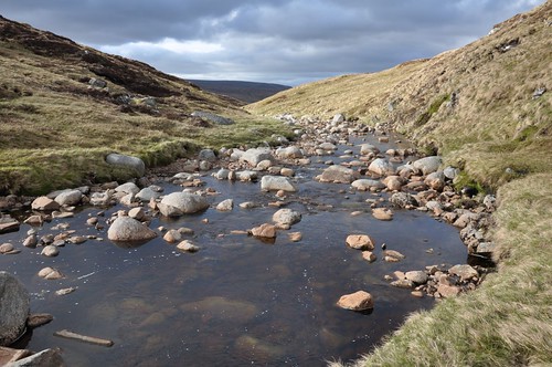
River Killin
I then started on my way up the north side of Glen Markie. The glen is wonderfully tree lined and my route overlooked another fine gorge. I started to look for a spot to camp and managed to pick a place as the glen widened, I had intended to go a bit further but time was getting on. My shelter was soon up and I settled down for something to eat.
Camp spot, Glen Markie
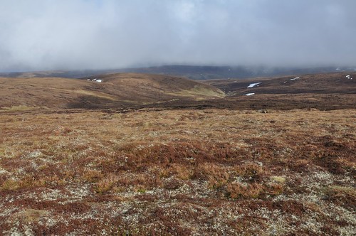
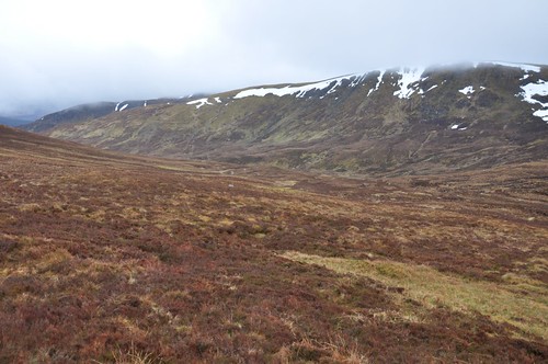
The following morning started a little grey as the day before, holding a slight threat of rain, but I head off up what was proving to be a delightful glen. Sheep and deer tracks and cropped grass provided a good start to the days walking.
Glen Markie
There were plenty of deer about on the hillsides while at the waters edge Sandpiper, Dippers, Wheatear and Meadow pipit all put in an appearance. Further up at a bend in the river a Golden Eagle gracefully lifted itself into the air and sailed away.
Glen Markie
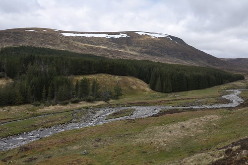
I continued up the glen until I reached the waterfall north of Burrach Mor.
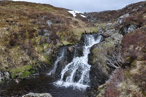
Waterfall, Glen Markie
I stopped here and got the stove out to make soup for my lunch and decide on my next move. Leaving the burn I worked up the heathery slope toward Carn na Laraiche Maoile.
Heading for Carn na Laraiche Maoile
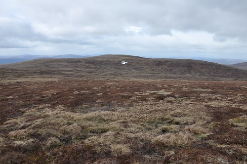
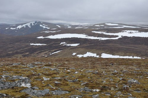
To the north lay my next objective across a large expanse of moor and what is effectively a building site as another wind farm is constructed. Across some rough ground I was soon onto Carn a Choire Sheilich before heading for the un-named 778 top of Carn na Saobhaidhe.
Beinn Bhurach (in shadow) & Carn na Saobhaidhe
A slight drop and then it was onto the next top and the point where I had a bit of an navigational meltdown. Some how I had convinced my self the hill to the NW was were I needed to head next and so off I strode purposely across boggy and peat hag ridden terrain. At the top I took off my rucksack and reviewed my position on the map. It was now that I realised my error, I was on Beinn Bhurach and not Carn na Saobhaidhe, indeed I had just come from there and now had to face a return over the rough ground Id just trodden, the air turned a little bit blue! There was nothing for it, I abandoned lunch plans and made my way back.
Beinn Bhurach from Carn na Saobhaidhe
The mist came down accompanied by some rain but I needed to get something to eat to boost my energy levels, so I hunkered down and brewed up An ugly bulldozed track leads NE off Carn na Saobhaidhe but I followed this for a short while on my way to Carn Mhic lamhair.
View from Meall a Phiobaire toward Dalbeg
While crossing to Meall a Phobia a Ptarmigan erupted from the ground just in front of me revealing a nest full of eggs.
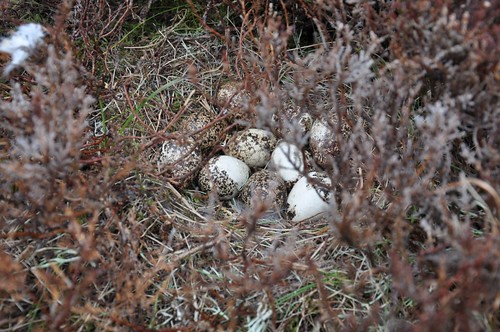
Ptarmigan nest
Another Golden Eagle took flight from a peat hag a little while later in area of many hare burrows.
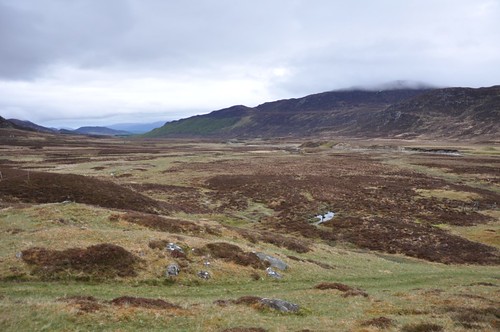
Heading for Dalbeg from Meall a Phiobaire
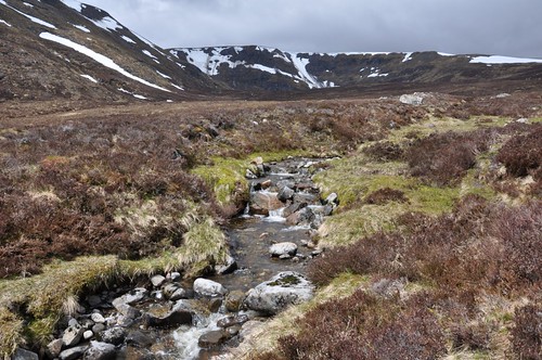
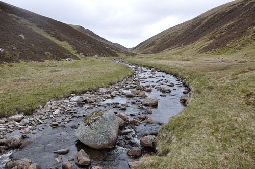
The showers continued as I followed Allt Odhar and then the track above Allt Creagach to the small hunting lodge at Dalbeg.
Allt Odhar
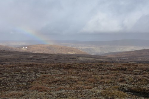
The sun put in a brief appearance and rainbow appeared just as I turned a corner to reach Dalbeg on the banks of the River Findhorn.
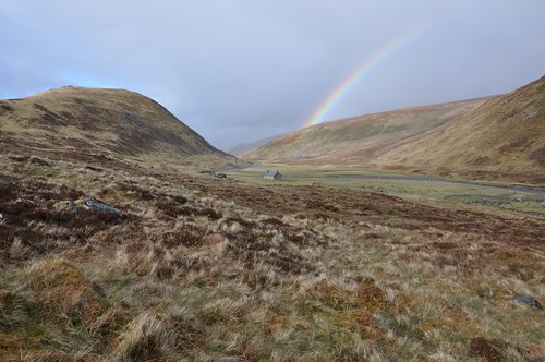
Dalbeg
Oyster catchers and gulls were having a disagreement as I made my way along this scenic glen to the next bridge.
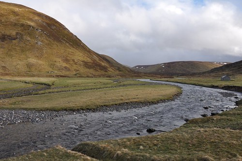
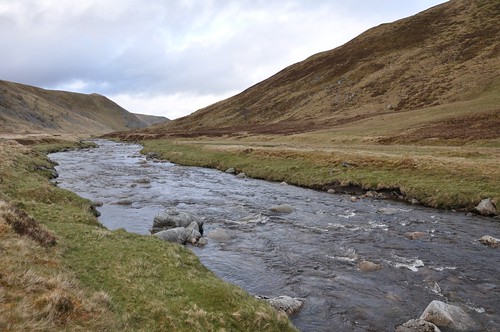
River Findhorn
The rain threatened a return and I started thinking about pitching the shelter just as Coignafearn Lodge appeared.
River Findhorn
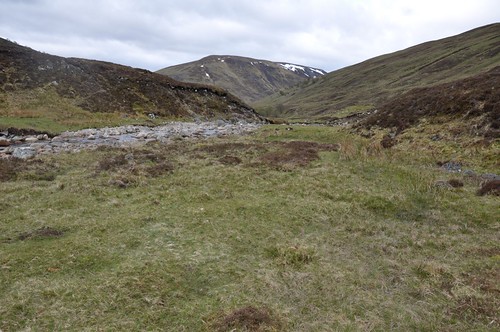
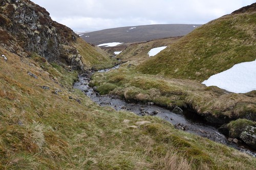
Turning south I crossed the bridge to work my way upstream along the Elrick Burn in the increasing drizzle. The waters were flowing quite strong and I thought I was going to have difficulty following the track across but managed to navigate a shallower section with too much trouble, again no need to worry about getting feet wet, they had been for most of the day. Eventually at the meeting of burns were a non existent building is marked on the map I found a suitable place to camp, again it was quite late. I quick splash about in the cold waters of the burn provided a welcome freshen up before I settled in for the evening. The idea of following the side of burns certainly seems to aid progress through the Monadhliath and it worked again as I revised plans to get over to Carn an Fhreiceadain. I had thought of following the high ground during my trip and while some of the tops are grassy a lot of the ground, certainly in between, is really rough going. There was a track heading SE between Meall nan Laogh and Carn Icean Duibhe, unmarked on the map, that help me on my way but I left it as it crossed the burn and looked to head up hill.
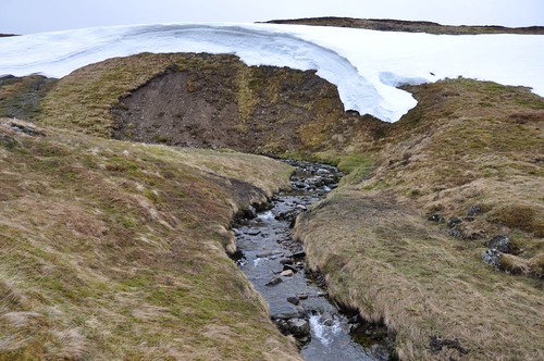
Caochan Mor Bun Fhraoich
Continuing along the burn I eventually reached the water shed before picking up a another burn that led all the way to the Dulnain bothy and a new estate hunting hut.
Carn an Fhreiceadain
After lunching out of the cold wind in the Bothy I used the River Dulnain as a handrail to reach the bealach between Carn an Fhreiceadain and Carn a Bhothain Mholaich.
River Dulnain
From the bealach I made the track that parallels the river, following this a short way before heading uphill past a few Grouse butts to gain the south west ridge of Carn an Fhreiceadain. From here it was a short way to the large cairn and a wee bit further to the trig and top.
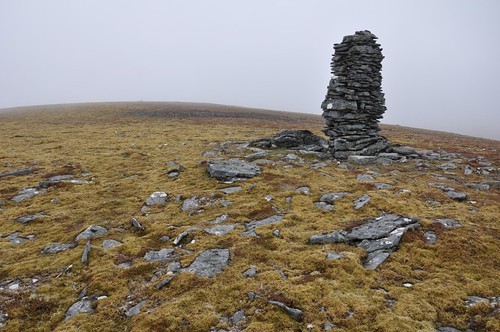
Cairn, Carn an Fhreiceadain
Retreating to the cairn I used it as a windbreak while considering next options. Mist was occasionally covering the higher tops but the weather did not seem overlay threatening.
A Chailleach & Carn Sgulain
Whatever ever option I took I needed to head east, a long way east. A couple of Jaffa cakes provided the stimulus to move off back down to the bealach and start up the slope of Carn a Bhothain Mholaich. Continuing east the I followed mountain hares across snow fields onto the NE shoulder of Carn Sgulain. The mist descended and rain started just before the top so I took advantage of a rocky outcrop and tried to shelter while waiting for a clearing; it didnt come.
Carn a Bhothain Mholaich
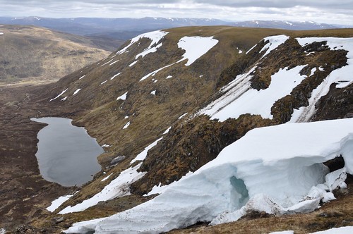
Compass in hand I went onto the 908 top I thought about missing out A Chailleach. What the hell, I here so may I may as well do it, maybe the weather would clear! The middle ground was exceedingly boggy and the small peat hags were actually welcome as I hoped across. Much of the slopes to the north of Allt Cuil na Caillich we snow covered but I found a gap and continued up to A Chailleach whilst being buffeted by the wind rain. A quick bite to eat was had before making the return across to the 908 top. Walking into the wind and rain now I could feel a cold dampening at my chest and around my waist. I picked up my pace a bit on the way to Meall a Bhothain to warm up. I remembered that the were old fence post that provide a guide along this section. I kept track of the tops as I progressed whilst just checking my compass occasionally for correct direction of travel. I think it was along this section that the rain stopped, well no, it just turned to hail and then eventually to snow. I found a little shelter afforded by a dip in the ridge and put my windproof on under waterproofs to add a bit more protection. Meall na Creughaich was topped followed by Carn Ballach and then onto the rocky top of Carn Ban. My original plan was to camp somewhere around here and then head east to drop into Glen Markie and join my outward track, but I had given up on this idea. I headed south along the Carn Dearg ridge and what would be my final hill of the trip. The mist extent clouded the extent of the drops off the ridge and meant the summit appeared eerily out of the clag as I approached. There was a bit of a step below cairn which afforded great shelter. In fact I thought it had stopped raining until I emerged to continue along the ridge. I dropped out of the mist as I descended and had a nice view over to Dubh loch and the many waterfalls streaming down the rock face of Sron nan Laogh.
Loch Dubh
I followed a high path a little way over toward the loch looking for the building marked on the map but saw none. Turning down into Gleann Lochain I picked up what could loosely be termed as a path, more a boggy stream.
Gleann Lochain
I sloshed, splashed and basically paddled along and again gave up hope of finding a pitch to camp. I eventually made it to into Glen Banchor and some sheep shanks after another slightly challenging river crossing.
Glen Banchor
By this time I had just about made my mind up to retreat completely and head back to the van, the wisdom of which I would question during the long trudge out along the road. But decision made I took the track down Srath an Eilich to reach the main road near Balgown. The road was very quite, which meant I had less chance of being run over but effectively meant there was no chance of hitching a lift. From Laggan back to the Spey Dam proved to be the longest 4km Ive ever walked! An hour or so after arriving back at the van and having being fed and watered I settled down for the night and was feeling a whole lot better. The next morning though I was really feeling the effects of the previous days walk but a stop for a fat boys breakfast at the fine Teapot café in Kinguisse soon had me feeling, if not moving, a whole lot better. A nice wee café this, run by a lovely warm and welcoming Spanish couple. Its a pity the weather didnt hold out as forecast as another half day would have made all the difference, but still a rewarding trip in many ways.
Top Of Page
site info
© 2007-2008 Paul Sammonds. Template Design by Andreas Viklund.