Footprints Across Scotland
Why not make a few of your own!
8th & 9th May 2010
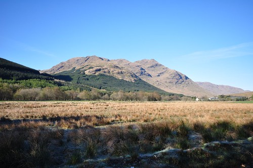
Stob a' Choin & Beinn Stacath from the shores of Loch Doine.
Its a very scenic drive along the shore of Loch Voil from Balquhidder but as with my trip down Glen Lyon recently the single track road requires a bit of care. However as it was dark the road had my full attention and I arrived at the car park or picnic area as shown on the map at around midnight. The skies were clear and the coldness in the air indicated that the expected frost would almost certainly arrive. After making a quick brew and taking a look over the map it was just about time for bed. In the morning while lying snug in the warmth of my sleeping bag I admired the iced patterns on the roof the van; they did little to encourage me to get moving. However after spying clear blue skies out of the window I decided to put the kettle on and shake a leg. Quickly dressed I began preparations for the day; made lunch packed my bag and checked over my route one more time. By 8 o'clock I was on the move following the private road up to Inverlochlarig farm formerly the homestead of Rob Roy Mcgregor (the place not the farm that is). After leaving the farm I continued up the track along the side of the river Larig.
Stob a' Choin
A small herd of cows were guarding the access to a bridge over the river but watched nonchalantly as I passed between them. Stob a Choin, the peak of the dog, is a steep sided hill and the grassy slopes certainly raised my pulse rate. I headed left toward the corner of a pinewood before following a burn upstream to a gate and onto a bealach below the east ridge of Stob a Choin.
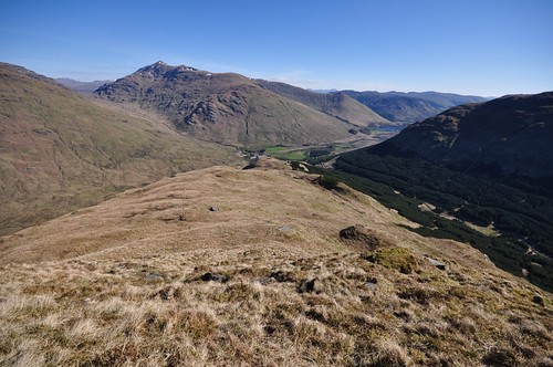
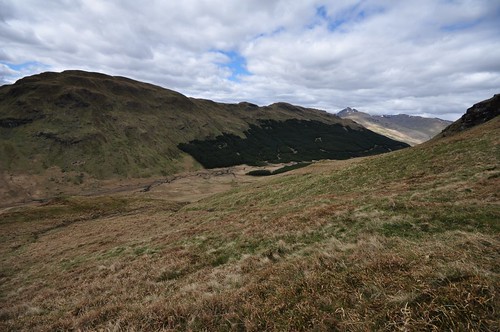
Inverlochlarig from Stob a' Choin
A boundary fence heads off from here leading pretty well all the way to the summit, although the fence quickly became an intermittent line of posts as I continued. The ridge undulates gently for most of the way apart from a couple of steeper sections which are reached when nearing the final tops. After the second of these dips there is a short final climb to the summit from Bealach Coire an Laoigh. To the south I could see a ferry making its passage across Loch Katrine, which gave me an idea for a possible trip up Beinn a Choin. To the north the river Larig wound its way up the glen through the foothills of many of the mountains normally climbed from Crianlarich. I had a grandstand view across the glen to the Munros of Beinn Chabhair, Beinn a Chroin, An Caisteal, Beinn Tulaichean, Cruach Ardrain, Stob Binnien and Ben More, their steep grassy flanks now showing silhouettes of gathering clouds.
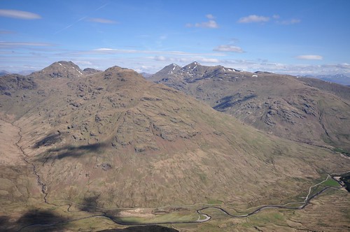
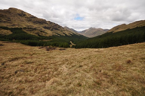
Beinn Tulaichean & Cruach Ardrain, Stob Binnien & Ben More
After returning to the Bealach I followed the course of the burn down the steep slopes turning some crags early on by traversing to my left. On reaching the river Larig I watched as a couple of Sandpiper dipping their way along the water course.
Beinn Tulaichean & Cruach Ardrain, Stob Binnien & Ben More
I took a little detour west to explore the cascades created by the Ishag burn which runs down from Cruach Ardrain. It was only early afternoon as I arrived back at the van so after a mug of tea and a biscuit I decided to take a wander around Loch Doine.
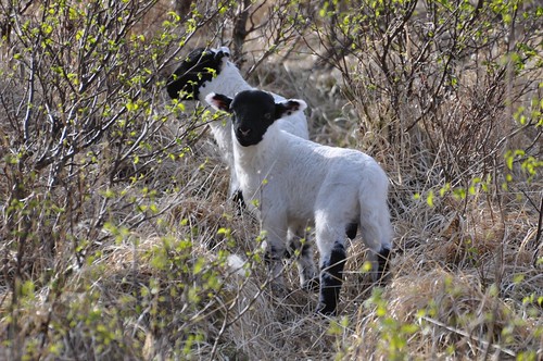
Twins
My plan for Sunday was to be a trip up Beinn Stacath, the usual route starts from near Balquhidder but I was hoping to do it from my current base on Loch Doine. I used my walk around the loch to try and see a way up through the dense pine covering the lower parts of the hill. Although there was one or two slim channels through the trees they lead to very steep and craggy ground. The sound of a woodpecker interrupted my thoughts but despite heading into the trees I was unable to catch a sight of it. The loch shore was very boggy in places but I managed to work around to where the outflow runs off to Loch Voil. A set of steping stones led across the short stretch of river but at one point the distance between stones was more than one step wide. Not wishing to remove boots I elected to make one quick step into the water at this point and fortunately avoided getting too wet a foot. I worked my way up onto a forest track and followed it as it ran back along the side of the Loch. My map showed the path as finishing at the end of the Loch but it turned up uphill into another glen following the line of the Invernenty burn. I was curious to see where it lead, hoping it would turn back around in my intended direction of travel. Time was getting on and so when the track hit a switch back heading further uphill I decided it was time to turn back. Down near the loch I managed to find a passage through the trees onto an area of marsh near the river Larigs entry into Loch Doine. The wet boggy ground kept me near the tree line and I made my way over some rough tussocks of grass. The light was now starting to fade a little as something ahead sprung through the deep grass and out of sight, it gave the impression of a large cat, maybe it was a wild cat or maybe just a fox? Further on I crossed the Invernenty burn before following it up to the banks of the river Larig. A large Canada goose landed in the marshes behind me seemingly unaware of my presence although deer further up moved off very much aware I was coming their way. It was nice to be on firmer ground and the short cropped grass was a lot easier going. Dusk was settling in as I traced the river bank when a stream of bubbles in the water caught my attention. As I peered over the edge of the bank an otter surfaced just a few feet away, it was as surprised as I was and turned with a mighty splash as it dived for cover. I thought that would be my one and only glimpse but it appeared at the river bank just a little upstream peering straight back at me for a few seconds. It then swam slowly out into the river before turning back toward me, very inquisitive it seemed, it then made a more relaxed dive that unfortunately took it away and out of sight.
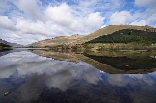
Loch Doine
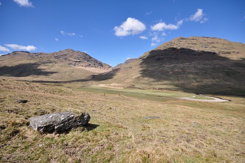
The following day I was hopeful that by continuing along the forestry track of the previous day I would reach a point that would give me suitable access to the slopes of Beinn Stacath; the peaky hill is only marked on the map as a 771m trig point. I followed the single track road along the north shore of loch Doine to reach the pink hotel at Monachyle. After going through a gate I followed Allt Carnaig keeping to the edge of the field to avoid disturbing the Sheep and their lambs. I cut across at the top of the field to again pick up the stepping stones at the outflow of the loch. After following the loch shore around to a wall an opening in the trees allowed access to a gate and the forestry track running below Ceann na Baintighearna. After 1.5km the track turned south and climbed the hillside for a further 2km. Occasional gaps in the trees gave views across the glen to Stob Breac and down toward Inverlochlarig. The track ended just after I passed a small log cabin tucked away on the hillside just across a burn. Open grassy hillside allowed me to climb up onto Beinn Stacath as hoped, the going was steep at times but I was soon closing in on the trig point.
Stob a' Choin from Beinn Stacath
From the summit I headed south before turning west over some peaty ground to the 715m top.
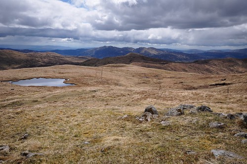
South from Beinn Stacath
After heading further south for about 1km I hit another patch of peaty ground before turning down between the crags and the base of An Stuchd.
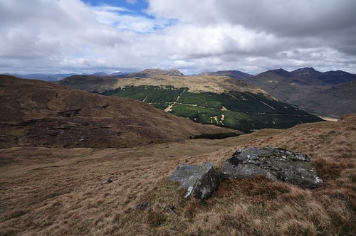
Stob Breac
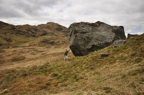
From the glen floor a rising traverse saw me follow some deer as they headed for the col between An Stuchd and Beinn Mheadhonach. I then started on my trek down Glen Sgionie passing some huge erratic boulders on the way.
Stob a' Choin
A deer fence blocked entry to the forest but a ladder style allowed me over. It was a squeeze between the fence and some of the pines braches while negotiating some very boggy ground, fortunately it was only for a few short meters. The Invernenty burn provided my pathway down hill until I reached the start of another forestry track after about half a km. The grassy track then eased my way slowly down to Blaircreich and a bridge to cross the river Larig and then shortly thereafter to the car park.
Glen Sgionie
As I headed for Balquhidder and the way home one or two heavy showers passed over Loch Voil. The limited parking spaces meant I didn't quite catch the the full arc of a rainbow that formed over the loch.
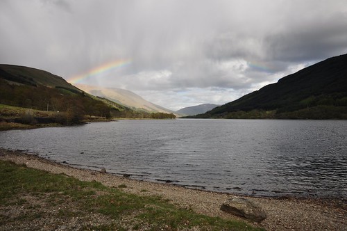
Loch Voil
Top Of Page
site info
© 2007-2008 Paul Sammonds. Template Design by Andreas Viklund.