Footprints Across Scotland
Why not make a few of your own!
22nd & 23rd September 2012
A trek through the wilds of Sutherland to reach the remote peak of Beinn Leoid (Sloping hill) followed on by a visit to the iconic Stack of Glencoul and tour of some of the areas numerous waterfalls.
Route Map
There are a good number of estate tracks and stalkers paths that offer up numerous route options while exploring the hills of Sutherland. My rough plan was to work my way up Glen Dubh from Kylestrome and over onto Beinn Leoid for a high camp before exploring the area around Glencoul and a possible walk out along the shore of the sea loch.
Beinn Leoid & The Stack of Glencoul
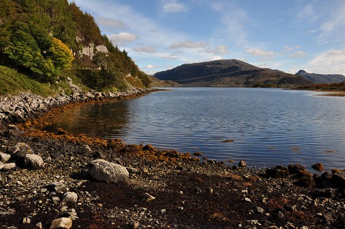
Leaving the van in the car park on the north side of the Kylesu bridge I made my way along the road to the small settlement of Kylestrome before picking up the path that runs along the shore of Loch Gleann Dubh. It was a very pleasant start to the walk as I ambled along under the shade of the loch side trees.
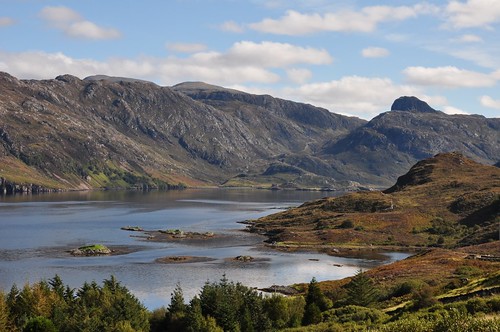
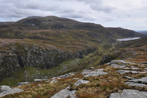
Beinn Aird da Loch
The idyll was interrupted for a short while a little further on as I discovered that the path had been widened to support a hydro scheme harnessing the power of the fast flowing Maldie burn which I believe has supported hydro power since early last century. Past the works I could start to enjoy the scenery once more as I progressed toward Glen Dubh.
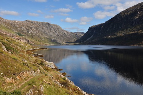
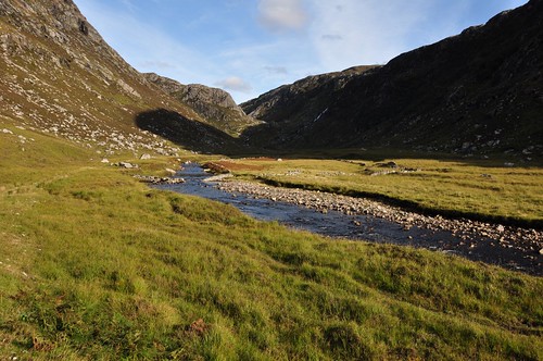
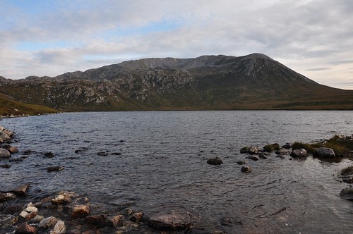
Gleann Dubh
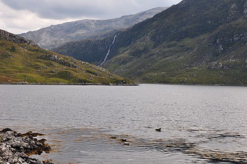
High cliffs on either side of the loch tapered as I neared the head of the loch giving rise to a fjord like appearance. I stopped for a brew and bite to eat enjoying the sunshine and surrounds while sitting outside the very tidy Glendu bothy.
Gleann Dubh, with Glendhu Bothy on the left
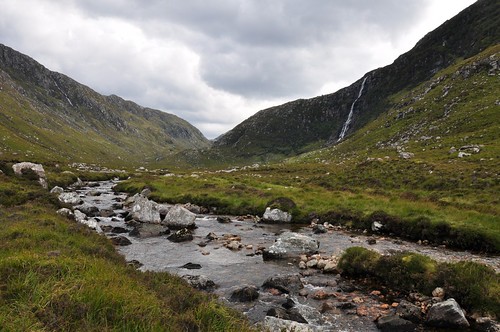
Adjacent to the bothy is a more substantial house, perhaps serving as a hunting lodge. A sign nearby gives an indication of any ongoing stalking on the estate - a red tag attached to the sign is used to indicate when shooting is in progress and access is limited; thankfully it was not showing today. The track now started into Glen Dubh proper, narrowing further as I worked my way up the pass. Another fine waterfall splashed water down the hillsides to join the fast moving burn below.
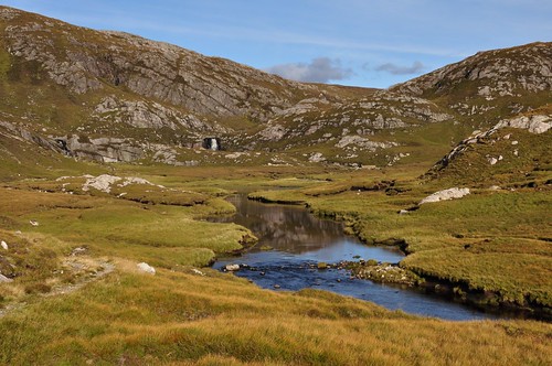
Gleann Dubh
After a bit of a climb up a series of zig-zags I emerged in grassy arena with a small lochan set amongst the boggy ground. Another waterfall, of no great height but wide and forceful, tumbled into one corner of the river flat.
Eas Creag an Luchda Waterfall
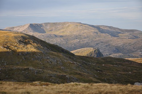
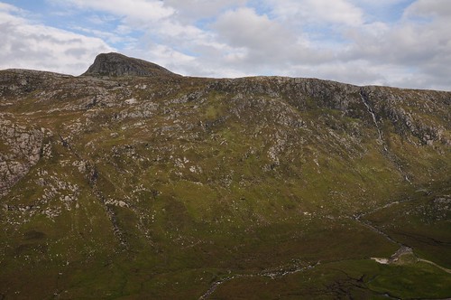
The track remained level for a while before another steep pull brought me to the tracks end. Distant hills now began to make their presence felt and I was soon able to pick out the tops of Ben Stack, Arkle, Foinaven and Meallan Liath Coire Mhicdougal. My objective for the day, Beinn Leoid, had also put in an appearance a little way across some rough heathery moor. Off the beaten track now I meandered between some peaty troughs to rise onto the shoulder of Sail na Slataich.
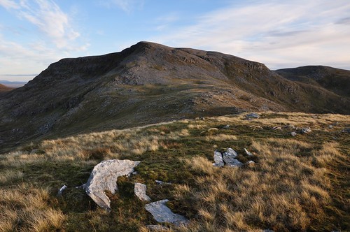
Beinn Leoid from Sail na Slataich
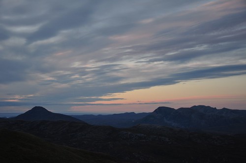
I was hoping to camp as high as possible but thoughts of a pitch on the top of Beinn Leoid where quickly put aside as I viewed the boulder strewn slopes leading to the summit. I briefly entertained the thought of going over the top and finding something on the other side but came across a reasonable, if damp, spot while crossing the saddle south of Sail na Slataich. Tent up and water bottles filled from a nearby burn I decided to wander up to the summit of Beinn Leiod. Using one or two grassy runways I managed to pick a good way through part of the boulder field before hopping and scrambling over the rest. My decision to pitch below proved to be a good one as the top didnt appear to hold any suitable alternatives. There was no spectacular sunset today but a gentle fading of light which seemed to speed up as I realised that darkness was approaching and I still has to descend about 500 feet back down to the tent over some unstable rocky ground.
Ben Stack, Arkle & Foinaven
It was indeed almost dark as I climbed inside my home for the night and set about starting on kitchen duties. Fed and watered I lay contented in the warmth of sleeping bag picking out the occasional star from a now rather overcast sky. A recent repair to my sleeping mat had not met with success and a few lung fulls of air were required on two or three occasions overnight to lift me from the cold damp ground. Morning dawned bright but the clear skies soon turned a little overcast as high cloud drifted in.
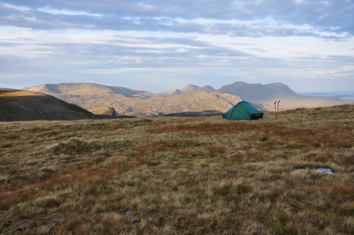
Camp on Beinn Leoid
Breakfast over and kit packed I was now ready to re-ascend Beinn Leoid.
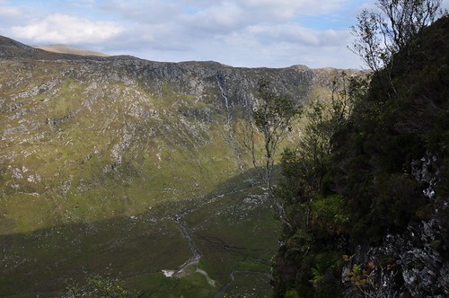
Glas Bheinn & Stack of Glencoul showing in middle distance
Mist was rolling over the top seemingly washed up from the water world of Glen Cassley to the south. Views came and went as I started my way over Bealach Beinn Leoid and thence Creag an t Sniomha.
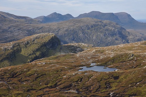
The Stack of Glencoul (left of center)
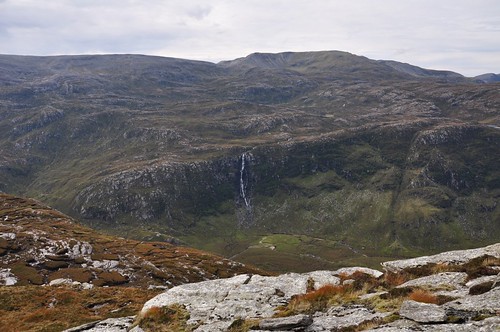
A feint curled ridge to the south and then a grassy shoot eased me down to the marshy ground below before picking up a burn on its way to Loch an Eircill. The burn dropped into a narrow steep sided gorge so I took the higher ground before a short steep slope allowed me to gain the shores of the loch. The stack of Glencoul sits at the end of a broad ridge that separates two deep trenches, Glen Coul to the north while the Glen to the south holds two fine waterfalls; Eas an t-Srutha Ghil and Eas a' Chual Aluinn. Crossing the outflow of the loch I made a rising traverse onto the ridge across peaty ground before the way levelled and soon reached the Stack. A short easy climb and I was at the top before dropping out of the wind behind a rocky outcrop and settling down to enjoy the views over lunch. Beinn Leoid was now mist free but the views south held my attention with the grey screes of Glas Bheinn dominating the high ground above Eas a' Chual Aluinn (waterfall of the beautiful tresses), the waterfall with the longest drop in the UK.
Eas a' Chual Aluinn Waterfall
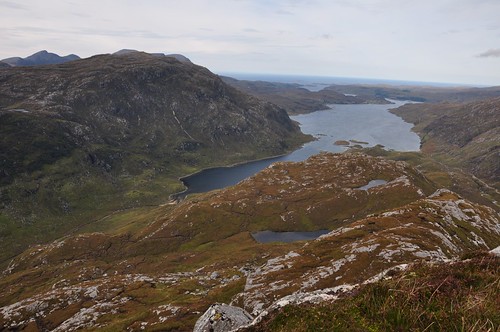
Loch Glencoul from the Stack of Glencoul
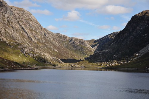
Beinn Leoid above Glen Coul
Views savoured and lunch complete I headed back toward Loch Eircill playing safe as I didnt fancy getting crag bound heading down any possible alternative route. I also wanted to pay Glencoul a visit and the pass down to the loch shore provided more splendid scenery including good views back up to the impressive rocky side of the Stack.
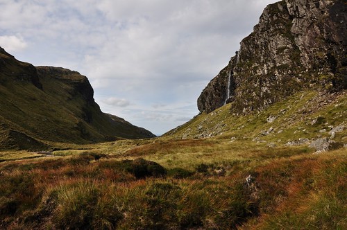
Waterfall in the pass through Glencoul
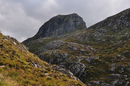
Stack of Glencoul
The bothy at Glencoul sits in a lovely spot in what is effectively an inland bay with tall cliffs at either side of the outlook and the Stack providing a fine backdrop. The bothy itself looks well kept and Im sure would provide a fine shelter for an overnight trip. I followed the track up toward the shore of loch Beag and surveyed the opposite shore for a possible route out to Unapool having briefly read of somebodys journey in that way. The cliffs at one point looked like they dropped directly into the sea and what appeared an all too straight path working around the cliffs turned out to be a wall when viewed through binoculars, obviously there for a reason for the wall so I quickly discounted this as a possible route out. A group of seals where basking near the shore of loch Beag but rolled into the water as I passed by.
Eas a' Chual Aluinn Waterfall
I continued to survey the walls of the Glen for possible routes but the mixture of crags, trees and shear steepness held little promise. I was almost resigned to continuing on to the head of the Glen to pick up a path but this would take some time and didnt really want to be heading home too late.
Eas a' Chual Aluinn Waterfall
As I approached the foot of the falls I eventually found a chink in the hillsides armour, a rising traverse to just below a band of tree bound crags would lead to the cleft carved out by a burn, reversing the angle of ascent would then lead to the top of the escarpment, at least I hoped so! A morning visit to the base of these falls would have been preferable being east facing. Although only mid-afternoon but heading into Autumn it meant they were already in shade and although easy on the eye the light was not really conducive to a good photograph. Shortly after beginning my ascent I picked out the hoped for signs of deer traffic on the ground, indeed higher up as route choices diminished a deer track established itself which kind of assured me that I would make the top and not have to turn around. Although steep the way up turned out just fine giving grand views across to the falls and over to Glencoul and eventually Beinn Leoid.
Stack of Glencoul & Eas an t-Srutha Ghil Waterfall
I emerged on the escarpment just a 100 meters or so north of where the waters from of Loch Poll Amhluaidh take their sudden plunge some 200 meters down to the glen below.
Eas an t-Srutha Ghil Waterfall
After following the path that follows the course of the burn back to the Loch I gained the main path and headed for Bealach a Bhuirich. It was a straight forward descent to drop to Loch a Bhuirich before a boggier path led around Loch Gainmhich and onto the main road.
Glas Bheinn above Loch Gainmhich
All that was now required was to catch a lift back to the van and I could start on the long journey home. It was ten minutes before the first car heading north appeared,.. and passed. The trickle continued and after a further 10 minutes I was reluctantly thinking about starting to walk when a young guy and his girlfriend pulled up and asked my destination, they were only heading as far as Kylestrome which turned out to be just about perfect. It turned out that he worked on the estate and said that they were pretty busy with stalking at present but Sunday as usual was a day off. He also mentioned that Id made the right choice in not attempting an exit around the north shore of Loch Glencoul as the cliffs do form an impassable barrier. Id noticed that a rough track had been created above the hydro scheme and he mentioned that this was because they had to route the power out over to Achfarry as the local sub station didnt have the capacity. Back at the van it was time for a change of cloths and wash ready for the long journey home after another fine trip to Sutherland (my third this year).
Top Of Page
site info
© 2007-2008 Paul Sammonds. Template Design by Andreas Viklund.