Footprints Across Scotland
Why not make a few of your own!
1st May to 3rd May 2010
A long weekend based at Shiel Bridge in Kintail taking in the South Glen Sheil Ridge, a coastal walk from the Kylerhea ferry point and Ben Killilan at the head of loch Long.
It was late by the time we reached the campsite at Morvich on Friday night. Fortunately the predicted rain hadnt arrived so at least it was dry while putting Nathalie's tent up. In fact it was a clear night and the sky was filled with stars. Job done and it was time for a quick drink before climbing into sleeping bags. It didnt stay dry for too long and I heard the patter of rain on the van roof during the small hours, fortunately it had stopped again before breakfast. It was still pretty misty but conditions were set to improve, I certainly hoped so as I didnt want my promises to turn out to be rash ones! A plan of action was hatched and we left Nathalies car a little east of the bridge over Allt Mhalagain before continuing in the van to the Cluanie Inn. We headed up the old road that leads from Cluanie to Tomdoun under a grey sky and some light drizzle. A short distance from the high point in the track a cairn marks the start of a good stalkers path that eases the way up onto the eastern end of the south Glen Shiel ridge and the first of seven Munros. We were leaving our options open which seemed just as well as the drizzle turned to sleet and then snow as we gained height. A cold wind was also trying to put a damper on the walk but another couple of walkers boldly backed up my earlier promise of better things to come. Soon enough we reached Creag a Mhaim just as the mist started to clear, although the ridge ahead did have a rather wintry outlook.
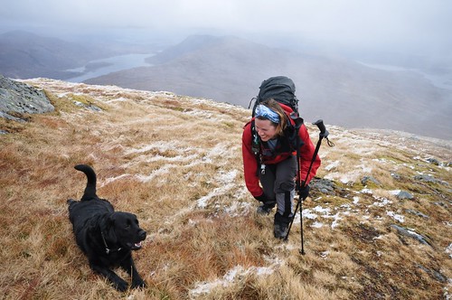
Nathalie and Enzo on top of Creag a' Mhaim
The ridge is gently undulating at this point and the shallow gradients up and down made for an enjoyable start to the walk.
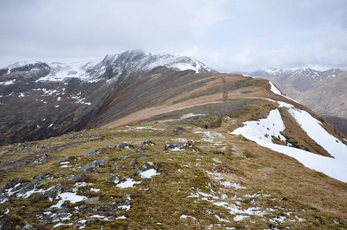
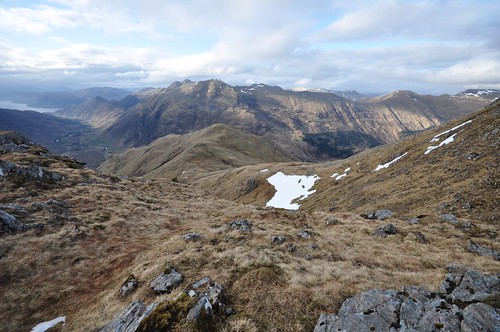
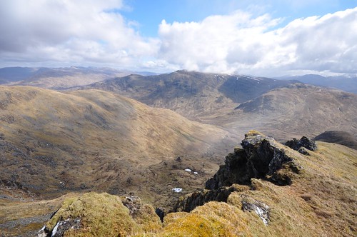
Druim Shionnach from Creag a' Mhaim
From Creag a' Mhaim we climbed Druim Shionnach, Aonach Air Chrith and then, Maol Chinn-dearg. To the north the tops of Mullach Fraoch-choire and A' Chralaig beyond passed in and out of mist.
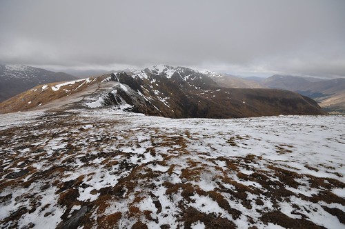
Aonach Air Chrith from Druim Shionnach
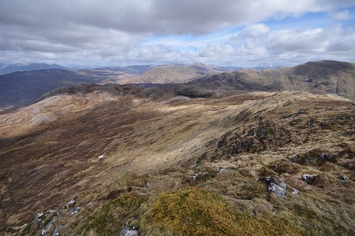
The ridge down to Glen Shiel from the next top Sgurr Coire na Fenne is a good route off the ridge and provides a convenient point when thinking of doing the ridge in two takes. We had already wandered over this top before I realised I hadnt checked with Nathalie that she was OK to continue, there was no problem as anticipated. The views along the ridge had stayed clear and we enjoyed the adjacent hills, the north Glen Shiel ridge on one side with the five sisters of Kintail at the western end and Saileag, Sgurr a' Bhealaich Dheirg & Aonach Meadhoin to the east. To the south of us lay Gleouraich, Spidean Mialach and Sgurr A' Mhaoraich (East to west). Sgurr an Doire Leathain was our next and fifth Munro of the day and the name gave an indication that the climbing was going to get steeper. My Gaelic is not so hot but I believe Sgurr means peak with steep upy bits followed by interestingly enough steep downy bits! Another pointy top followed in the form of Sgurr an Lochain before we approached the lowest point on the ridge after bypassing the top of Sgurr Beag.
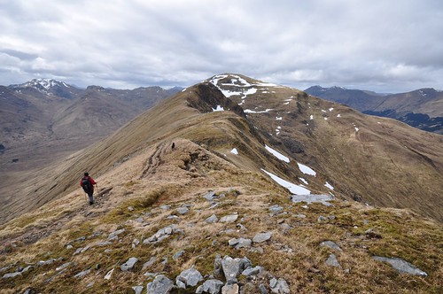
Maol Chinn-dearg & Sgurr an Doire Leathain
This low point is still at 730m but does mean that the final climb to Creag nan Damh requires a bit of effort not just because it is the last big ascent of the day but the culmination of a long series of climbs. We decided to continue along the ridge past this last Munro towards Sgurr a Bhac to descend from Bealach Duibh Leac into Coire Toiteil.
Five Sisters from Creag nan Damh
The path off the ridge was a bit rough and wet with plenty of loose rocks so required some care. Sgurr na Skine and Faochag lay opposite our path and the angled ridge of Faochag seemed as severe as any in this area of many steep sided mountains. The last obstacle of the day was the crossing of Allt Mhalagain but we managed to pick out a line of large boulders to help cross the fast flowing river. It was quite late as we finished, nearly nine oclock, a full 10 hours after our late start. A hot shower and a bite to eat at the campsite soon had us revived but the following day we decided that something a little gentler was in order. A trip across Bealach Ratagain took us down Glen More toward Glenelg before we turned off to Galltair and the parking area above the Kyle Rhea ferry crossing point.
Across the sea (Kyle Rhea) to Skye
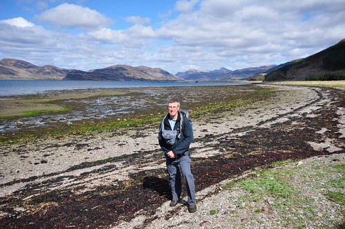
After starting back along the road toward Galltair we passed over a stony beach with a fine outlook over Glenelg bay.
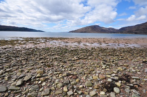
Glenelg Bay
We followed a small side road up to a cottage before finding the start of a footpath leading up the hillside from around the front of the house. The footpath followed the line of Allt Mor Ghalltair up onto some boggy moorland before passing east of Creag Dubh and a little below Bealach Luachrach. A gate took us into a forest and along a fire break to join a forestry track. It was now all downhill to Ardintoul Bay and a pleasant lunch spot near the Point.
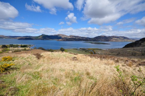
Loch Alsh from above Ardintoul
Following the loch shore to Camas Nan Gall we passed a fish farm a little offshore in the straits of Loch Alsh. Even from a distance it was evident that there were some very big salmon out there as they made a fair splash as they beat their way across the water using their tails.
Camas Nan Gall
At the end of the beach a steady climb took us back up into tree cover and along the top of the headland and eventually our starting point. On our return to Shiel bridge we stopped at the Druim Sgurr nan Cabar viewpoint which gives a grandstand view of the Five Sisters of Kintail. The picnic benches here provided seating for us to enjoy the view, a brew and chocolate biscuit. Nathalie was working Monday so unfortunately she had to head off for home while I took the short trip along loch Duich to Eilean Donan castle where I made my evening meal as the sun started to set.
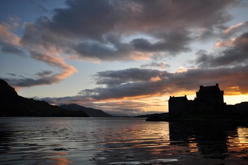
Eilean Donan castle at sunset
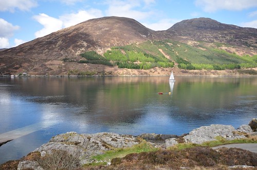
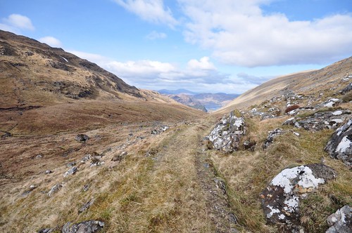
My plan the next day was to go up Sgumain Coinntich so I headed up the length of loch Long to the car park at the start of the private road leading onto the Killilan estate. Although there are a few homesteads scattered along the way there was a strong feeling of remoteness as the road followed the narrow loch as it wound its way between steep hillsides. As the road made a final turn approaching killilan the scene was dominated by the silhouettes of Beinn Killilan and Sgumain Coinntich standing tall at the head of the loch. I made an early start the next day under mainly fine blue skies although some clouds were moving in on the strong breeze. I took the estate road the final few hundred meters to Killilan before following a small path between a stone wall and Allt a Choire Mhoir. The path rose pleasantly under the shade of the trees before taking a sharp left turn. Shortley after ignoring a hole in the fence that lead to an old wooden bridge I reached and passed through an old iron gate. The feint path from here improved as I climbed before it joined and then crossed a wider track. It was now steady going as I climbed to the upper reaches of Coire Mor and the end of the track.
Loch Long from Coire Mor
I then arced around the hill gaining height gradually over the grassy ground as I made my way to Bealach Mhic Bheathain. About a 100 meters from the top of the bealach I stopped to pick out a route that would lead me through this craggy northern face of Sgumain Coinntich. A forty five degree rising traverse starting above the largest of the lower crags gave reasonable passage save for a couple of steeper sections where some handwork was required. I made a good mental note of my chosen route as I would need return the same way to avoid straying onto more difficult terrain. After gaining the ridge it was a steady stroll weaving around some rocky sections before reaching the trig point and summit cairn.
Loch Long from Sgumain Coinntich
The weather had changed somewhat during my climb and snow showers accompanied me over the last few hundred meters. The winds however soon had the weather system rolling on further south but the views north indicted there was potential for more. After a break I headed back down to the bealach and then up onto the top that sits between Sguman Coinntich and Ben Killilan. As another snow shower passed through the views into the huge basin below me suddenly brightened.
Faochaig from above Bealach Mhic Bheathain
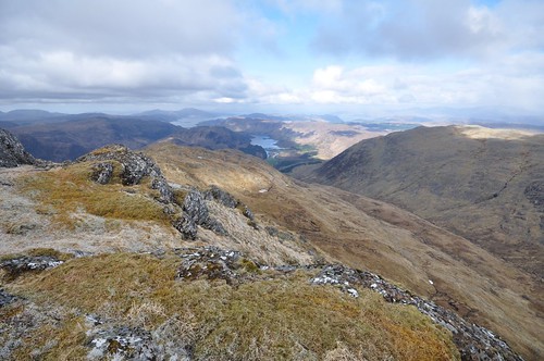
Sguman Coinntichs eastern ridge runs around to Sron na Gaoithe before continuing onto Faochaig and lower top Carn nan Searrachand. The deep hollow below contained three corries, Coire Fraineach, Coire Caol and Coire Shlat. Ben Killilan is an elongated mountain with a wide undulating but fairly level ridge with a number of tops of similar height. I traversed around Coire Mor to what is marked on the map as the highest top before heading along to the last one at the eastern end.
View over to Attadale from Ben Killilan
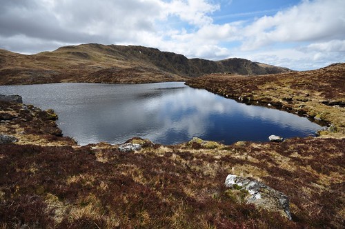
A narrowing ridge from here eased me down to a lochan where I sat for lunch enjoying the displays of a number of Wheatear and Meadow Pipit while the call of a nearby Ptarmigan could occasionally be heard. It was only as I made to leave that I spotted the Ptarmigan perched unusually high on the rocky top behind the Lochan.
Beinn Killilan from my lunch spot
The outflow of the loch gave access to a feint path which shortly left the burn Allt Coire Dail Aiteil to head down across boggy slopes. The direction of the path became easier to pick out as the grasses had become flattened by the wheels of passing vehicles. As the track approached steeper terrain it became well defined before it zigzagged through some tight turns down to Glen Ling. A Cuckoos song echoed around the hillsides as I reached the glen, a good indication that maybe spring had eventually arrived. It was now quite warm especially when out of the wind but it was very pleasant walking along the road way. A large number of deer gave thoughts of running off as I wandered past but they just increased their distance from the road a touch before returning to their grazing after I had gone by. As the river Ling neared the road I decide to nip down to the tree line and test the waters; very refreshing! After my dip it was just a final couple of Km and I was back at the car park; the end of another walk and the start of my journey back home.
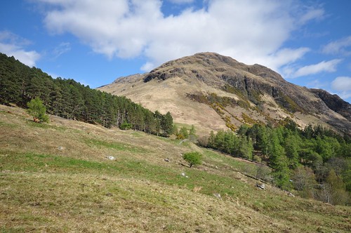
Sgumain Coinntich from Killilan
Top Of Page
site info
© 2007-2008 Paul Sammonds. Template Design by Andreas Viklund.