Footprints Across Scotland
Why not make a few of your own!
25th May 2013
A round of the Glen Galmadale horseshoe (Morvern) taking in Fuar Bheinn (Cold mountain) and Creach Bheinn (Mountain of spoil)
Route Map
It was a pleasant drive from my campsite at Resipole on the shore Loch Sunart to Morvern on the Ardnamurchan peninsula. A small area has been set aside for walkers near Glengalmadale farm; I was parked up and away before anybody else had arrived.

Creac Bheinn from Glengalmadale
After crossing back over the bridge that fords the Glengalmadale river, I followed the road a short way to the edge of a small plantation and began the steep climb alongside the edge of the wood.

Plantation edge marks the way up
Patches of Bluebells coloured the hillside just above the treeline at which point I traversed away from some precipitous crags onto the broad south west ridge of Beinn na Cille.

Glen Galmadale
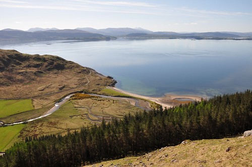
Camas na Croise
The grassy slopes of Bheinn na Cille were interspersed with a few small crags and pockets of primroses.

Sgurr a' Bhuic
The top seemed a long time coming but eventually the steepness eased and I took a breather surveying what was in store for the day ahead.

Fuar Bheinn and Creach Bheinn from Bheinn na Cille
Further west the complex ridge and corries of Beinn Mheadhoin showed well across Loch a Choire.

View south to Beinn Mheadhoin
First off I would need to lose some of the hard won height by dropping steeply to the col separating Beinn na Cille and Fuar Bheinn.

Fuar Bheinn and Creach Bheinn at the head of Glen Galmadale
A number of newts swimming in boggy pools provided a good excuse for a short break at the col before my next ascent.

Fuar Bheinn and Creac Bheinn
Further steep grassy slopes became broken by small rocky outcrops as I neared the summit. I was soon joined by another walker as I soaked up the sunshine and had a light snack. His geological background made for interesting conversation before he headed off.

Creach Bheinn from Fuar Bheinn
Another big drop and the wide boggy col above Coire a'Chuill Mhaim were in store before easier graded slopes leading onto Creach Bheinn. I followed the North West ridge of Fuar Bheinn quite a way down before finally dropping to the col to make a long loop round. As I was taking a couple of photos I was passed at a distance by a lady walker who waved as she took a more direct line.

Creach Bheinn
Part way up Fuar Bheinn however she stopped for an energy bar and I caught up with her. As we were chatting the realisation dawned that we may have possibly met before. It was only when the conversation turned to Aberdeen that we finally made the connection. Gayle and I had attended the same dance classes; however I was a bit shocked when Gayle said she reckoned it was nearly 10 years ago! We continued chatting as made our way onto the top. Fuar Bheinn is the highest point in Morvern and has great views into Ardgour with Garbh Bheinn just across Glen Tarbert and its highest peak, Sgurr Dhonuill, a bit further in the distance. A little North of the top there are some ruins, marked on the map as 'camp'. Ive seen it written that these are the remains of a look-out post from the times of the Napoleonic wars. But they are also recorded by the Royal Commission on the Ancient and Historical Monuments for Scotland as Creach Bheinn, survey camp and cairn. The ruins are the remains of a campsite, believed to have been constructed by soldiers of the Ordnance Survey early in the 19th century as part of the first triangulation of Scotland.

Gayle at Camp

Garbh Bheinn from Creach Bheinn
After leaving camp we passed over a rocky knoll onto a narrower section of ridge leading down to the bealach before a final climb onto the domed summit of Maol Odhar. Gayle was wishing to save a bit of energy for a walk up Beinn Resipole the following day so we said our goodbyes and wondered what the chances were of bumping into each other again on a distant hill somewhere. Gayle headed down Meal Odhar's south west ridge into the Glen Galmadale, while I continued on a pleasant stroll along a broad ridge to Meall nan Each. The way then became a little more undulating along the top of Druim na Maodhalaich with its numerous little knolls.

Meall nan Each from Maol Odhar
One of the reasons I wanted to continue along the ridge is that I had heard that feral goats graze here on the rather precipitous eastern slopes that drop to the shores of Loch Linnhe. I wasnt disappointed as I soon came across a small group of them. They made some rather unwelcoming noises as I approached before hurriedly heading down hill to assume a safe distance.

Feral goats
After following the ridge almost to the end it was then just a case of easing down to the road side and a short walk back to the parking area.

Fuar Bheinn and Creach Bheinn from Druim na Maodhalaich
It had been a fine day and a good round of hills with plenty of ups and downs on some steep slopes but with plenty of very fine views.

Camos na Croise
Top Of Page
site info
© 2007-2008 Paul Sammonds. Template Design by Andreas Viklund.