Footprints Across Scotland
Why not make a few of your own!
21st to 30th November 2009
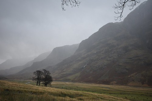
A wet week based in the valley of the weeping, Glencoe.
My last visit to Glencoe was to traverse the spectacular and airy Aonach Eagach ridge and I had enjoyed some fine September weather in 2007. The valley of the weeping was a much wetter affair as I arrived on a pretty bleak November day. The mist was rolling over and down the mountain sides on a strong wind which wouldn't have been pleasant to be out in but provided an enjoyable vista when viewed from the comfort of the car. My base for the week was to be Potters cottage in the village of Glencoe.
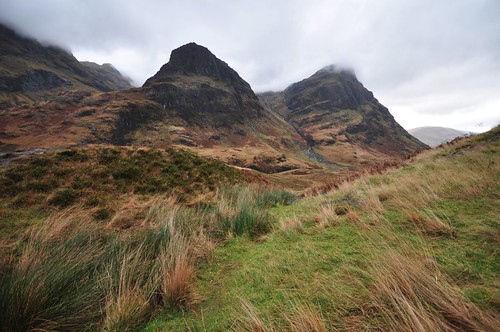
Three Sisters Glencoe
Sunday started with some brightness which encouraged me to get ready for an excursion to the hills, Sgorr na Ciche better known as the Pap of Glencoe was to be my choice. Sitting at the end of a long ridge the Pap looks diminutive next to Sgorr nam Fiannaidh which overlooks it from the east but at 742m with a steep ascent it would provide enough of a challenge for day one. Leaving the cottage I wandered up the road and was soon crossing the bridge to leave the villages solitary street. A turning on the left goes to the hospital and parking for the forest walks and I headed that way for a few meters before turning right and along a forest path that ran adjacent and then rejoined the main road. Ignoring a wide forestry road I continued on to where a pair of gates lead to parallel tracks heading up hill. The one on the right also had a kissing gate that allowed access to a second gate that requested that it be kept closed to keep the hairy beasts that roam the hillside from escaping. There were no highland cows to be seen but their presence was evident by the boggy state of the path in places. A short way up the hill a bridge forded the burn onto a reasonable path that made a rising traverse before crossing another burn to then follow its course uphill. I was gaining height quickly and soon had views back down onto Loch Leven as well as across to the complex ridges of the Bidean nam Bian massif. As the path began a long zigzag heading east the rain started so I stopped to don waterproofs. After turning west the path heads onto the col between the Pap and Sgorr nam Fiannaidh before winding around to the north and onto the top. The rain was turning wintry on occasion giving into hail and sometimes a touch of snow before becoming wetter again. A group of Ptarmigan took flight as I reached the top where I lingered for a while hoping the slight brightening in the sky may be the forbearer of some better conditions. The views, although a bit obscured and hazy, where no the less very enjoyable but the rain continued so I decided it was time to retreat.
Loven Levan from the Pap of Glencoe
I headed off down the north east ridge to extend the walk and keep the weather at my back.
The descent was steep, wet and very slippery and I took my time; not sure that had made the best decision.
Lower down I traversed above some crags and headed over onto a path above the road and the shores of loch Leven.
This would lead me around and into Glencoe forest and eventually onto the upper reaches of the forresty road I had passed earlier in the day.
I took a right turn and followed it slightly up hill to its end before taking a path on the left that traversed the hillside while leading through the trees and out onto one of the forest trails.
After taking a right turn uphill the way turned downward to bring me out at Glencoe Lochan.
After a half circuit of the lochan I stopped at the shelter at the west end to get out of the rain and enjoy some well earned sandwiches and a mug of tea.
From here it was all downhill out of the forest and the a short walk back to the cottage and time to get out of my wet boots.
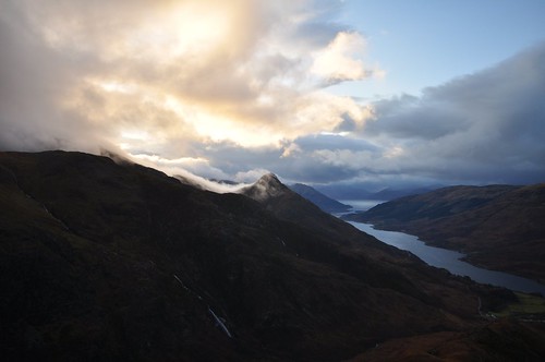
Loch Leven is a sea Loch which runs 13 kilometres west from the village of Kinlochleven to connect with Loch Linnhe and thence to the sea.
Mountains north and south provide a steep sided corridor along the lochs east end.
The rugged hills that rise from the loch shore are bounded by even taller neighbours.
To the north Mam Na Gualainn and Beinn na Caillich are overlooked by the Mamores while to the south Garbh Bheinn is shadowed by the Aonach Eagach ridge whose serrated edge stretches between Meall Dearg and Sgorr nam Fiannaidh.
After parking by the bridge at Caolasnacon I ventured up the path along the east side of Allt Gleann a'Chaolias for 400 metres before striking out across the grassy vegetation toward a band of crags.
After a few paces I picked up a boggy path that guided me up through the band of rock and onto Garbh Bheinn's west ridge.
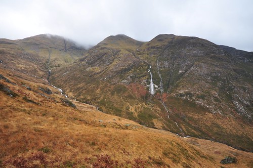
I continued to squelch along climbing steadily while enjoying the long waterfalls as they slid down the hillsides on my right.
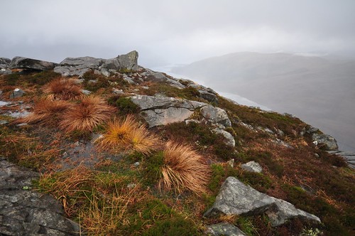
The North side of Aonach Eagach
After crossing a level piece of marsh the rocky spine of the mountain was more evident and much firmer footing was found as a steep narrow path worked up to reach and bypass another line of crags. After a final false top a short descent was followed by the final steep pull weaving through some crumbling quartzite slabs and then onto the more rounded summit. The mist had descended during my climb and the wind and occasional shower soon had me retreating back down to look for a sheltered lunch spot. As I repacked my rucksack after some warming tea in preparation to head down there were some encouraging signs that the mist was lifting. The smooth contours of the Mamores appeared to the north while the pinnacles and pillars of the Aonach Eagach gave a contrasting view to the south.
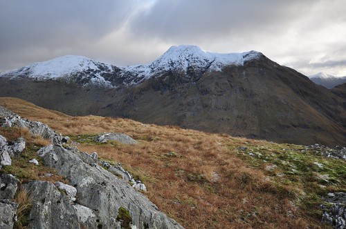
Mamores
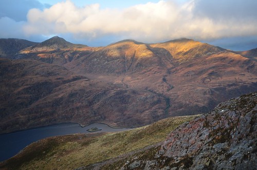
I decided to return to the top to gain some wider views and was rewarded with the sight of an eagle as it hovered in the returning mist. Another clearing allowed views out east along the lengths of Loch Eilde Mor and the Blackwater reservoir. Views came and went as I made my descent but the weather cleared for longer periods as the light faded providing a lovely silhouette of the shapely Pap of Glencoe.
The Pap of Glencoe and Loch Levan
The weather really set in over the next few days and I was restricted to a couple of trips out in the car.
Three sisiters of Glencoe
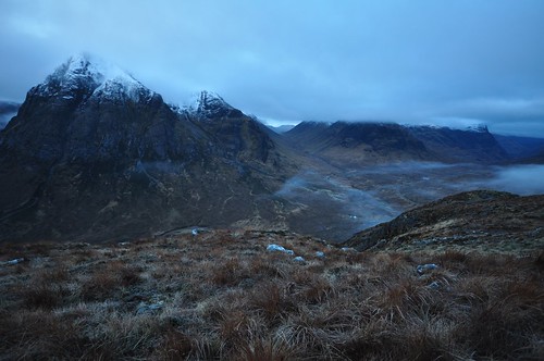
After four days of rain I eventually had a chance to stretch my legs and decided on an early start, I arrived at Altnafeadh in upper Glencoe at around 7am. Clear skies overnight and a drop in temperature had ensured a frost but the stars were still out giving hope for a bright start. Rising out of lower Glencoe the car was enveloped in mist but it did not appear too thick but I still nearly missed my lay-by. I was all ready to go so began on the West highland way as it makes its way to Kinlochleven via the devils staircase. I required my head torch to start as I left the path and made my way to reach the fence that encloses the wood at Altnafeadh. Working my way along the back of the wood I had to negotiate another three fences to reach the open hillside. Working my way up hill I didn't feel the chill of the below freezing temperatures. The way was a bit boggy but the frost had firmed up some of the steep ground and I was soon above the mist and could just make out the huge silhouette of Buachaille Etive Mor on the opposite side of the Glen. There were a few deer about having breakfast and they took a little while to notice me in the semi dark before heading off making light work of the slopes. As the light improved I could see that mist was covering the tops and the earlier clear skies were now covered by grey clouds. At about two thirds the way up were the slope eases I decided to wait here to see if things would clear and allow a couple of photographs as daylight broke proper. The Buachaille looked very impressive even in the restricted light but I eventually decided to head on up as the cold started working its way into my boots.
Buachaille Etive Mor
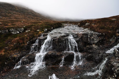
It was now a steady climb all the way to the top working through the snow cover for about the last kilometre. As I reached the top I could see the trig point illuminated in the mist as the sun tried to break through directly behind. The grey above turned blue as it teased the possibility that the misty veil would lift. Although only around 10am I decided to enjoy a sandwich and a hot drink behind the shelter of some rocks, the wind was only light but still had a bit of bite. I waited for a good while and the sun tried to break through a few times but they were all false dawns; it was time to head down. Beinn a'Chrulaiste is linked by a curving ridge that drops northward before turning west to join Meall Bhalach. I used my compass to negotiate the snowy slopes till I had almost dropped to the col to the east of Meall Bhalach, this hill could have provided a continuation for the route but seeing as the twin tops were cloaked in mist I dropped south into corrie Bhalach heading toward the Kings house hotel. It was extremely wet and slippery under foot, especially when standing on the stems of the longer heather. After reaching the Alt a'Bhalach I followed its course as it trundled down hill over a number of cascades and small water falls.
Beinn a'Chrulaiste burn, Alt a'Bhalach
My boots were squelching again by the time I rejoined the West Highland way near the hotel. It was now just a case of following the way the three and a half km back up to Altnafeadh enjoying the views of the still mist topped hills across the moor. The mist evntually cleared as I neared Glencoe village and a full moon appeared in the clearing evening sky. I drove down to the bridge at Ballachulish to view the Pap of Glencoe.
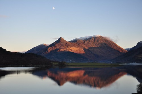
The Pap of Glecoe across Loch Levan
At the start of the walk up Gleann-leac-na-muidh you are confronted with the impressive and impossibly steep looking nose of Aonach Dubh a' Ghlinne. The southern flanks stand at a marginally shallower incline and provide a stamina testing route up onto the ridge that wends its way round to give access to Sgorr na h-Ulaidh. Looking back down the glen you are greeted with a view of the serrated tops of the Aonach Eagach ridge with its similarly sheer slopes. The Alt na Muide flows down from the slopes of Sgorr na h-Ulaidh to join forces with other burns at a point were the path starts to turn south, it was here that I headed west across the burn to pick up the lower part of Meall Ligniche's northern ridge. The wind was gusting strongly so I decided to keep off the crest and follow a line on the west side which provided steady sheltered progress up the grassy hillside. I eventually climbed onto the ridge just after the minor top of Creag Ban to be greeted by the full force of the icy wind. The ridge turns west from here and follows a slight incline to the summit that I'm sure normally provides a relaxing finale to the climb; today however I had to battle with the wind just to stay on the path.
Sgorr na h-Ulaidh
There was fortunately some shelter to be gained behind some rocky outcrops near the top and my first job out of the biting wind was to don a few more layers. Reasonably comfortable I had lunch as a number of hail showers passed over. I thought the wind had eased somewhat until I approached the part of the ridge immediately prior to it turning south and again felt its force. I felt warm enough apart from my hands as the wind quickly set about sinking in its icy teeth as if my gloves had been stripped away. This was quite painful until I gained some added protection and warmth by retracting my hands into the comfort of my sleeves from were they quickly recovered. I kept to the ridge line as it undulated its way down to the glen below avoiding one or two small crags.
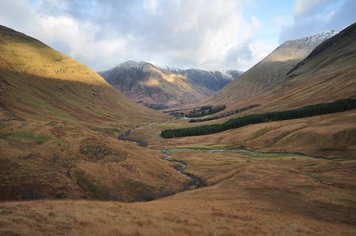
Gleann-leac-na-muidh
I was soon back on the landrover track that would take me all the way back down to the main road at the end of an entertaining days walking and the last outing of the holiday.
The best of the weather turned out to be on the final day so after tidying and leaving the cottage I took my time enjoying the cold sunshine.
I took a few photographs as I journeyed my way back through Glencoe and across Rannoch Moor.
Aonach Eagach ridge, Glencoe
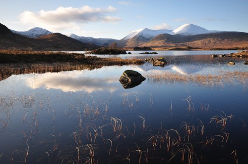
Blackmount across Lochan na h-Achlaise
After passing through Killin I travelled the length of Loch Tay reaching Kenmore as the sun went down.
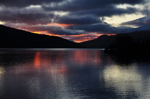
Sunset over Loch Tay
Top Of Page
site info
© 2007-2008 Paul Sammonds. Template Design by Andreas Viklund.