Footprints Across Scotland
Why not make a few of your own!
29th January 2012
An extended trek from Bridge of Brown to vist Geal Charn (white cairn) near Dorback on the edge of the Cairngorms.
Route Map
Geal Charn can be reached quite easily from the end of the minor road that leads to Dorback lodge. Looking to add something extra to the walk I decided on extending a previous trek that made an approach from the Bridge of Brown. After managing to park at the bottom of the switchbacks just before the bridge I crossed the road and followed the sign indicating the way to Glen Brown. The track heading for the glen was rather muddy and ice encrusted before passing through a small wood and emerging into more open countryside.
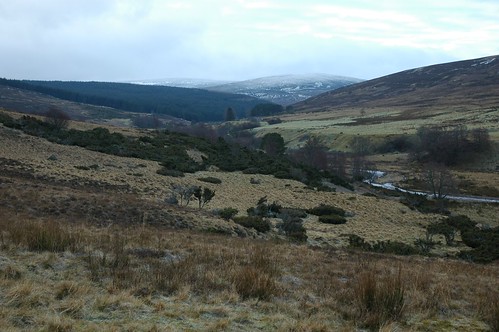
Glen Brown
Three stags were drinking down by the burn of Brown but hastily crossed the river and disappeared into the distance on hearing my rather noisy approach. The track winds its way up to a ruined farm building to a point were the map indicates a path dropping toward the river. The path looked distinctly boggy so I headed up the grassy field beyond the ruin to pick up another track that lead to the edge of a plantation. Following the edge of the plantation leads down to a more defined track that took me to the edge of a conifer plantation and the burn of brown. Crossing the burn I picked up another track that couldn't decide which side of the burn it should be on. I stayed on the east side rejoining the track whenever it re-crossed the burn to my side. It was very pleasant walking and the sun tried to brighten things further by occasionally breaking through the clouds. The slopes of Tom an t-Suidhe Mhor lined one side of Glen Brown while the plantation filled the other.
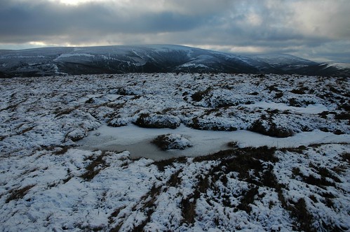
Carn na Farraidh above Burn of Brown
As the burn turned from south west to south east I took what looked like a stalkers path up the side of a bank. The path faded but lead onto a land rover track which I followed a short while before taking a branch heading up hill. I was soon pushing through the heather whose upper stems were coated thickly with snow . A large group of hinds were walking across the hillside above me but as soon as one broke into a run the others followed.
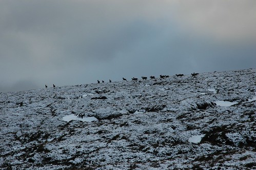
Deer on Carn na Farraidh
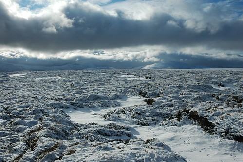
On gaining the broad rounded ridge I was then exposed to the wind and while not particularly strong delivered a bitter chill. The going was hard enough however to keep me warm as I worked my way over the snow covered heather, bog and peat hags.
Carn na Farraidh from point 656
The summit of Carn an Farraidh itself is no more than a collection of peat hags but does provide extended views into the Cairngorms. Somewhat closer lay Geal Charn but first I would need to drop south down to the estate road that separates the two hills.
Geal Charn from Carn na Farraidh
It was from here that I detoured from my previous outing in these parts, a few years earlier I had covered most of todays route with the exception of Geal Charn. Nearing the bottom of the ridge a set of vehicle tracks lead the way and after crossing the land rover track I followed another set as pointed the way uphill along side a burn on the vague east ridge. Any water lying on this, the shady side of the hill had turned to ice and had me tramping over heather to gain some purchase. The heather thickened along with the snow cover and the increasing incline soon had me gulping in lung fulls of the refreshing air. A snow bank required me to kick in few steps before I returned to the vegetation which thankfully shortened as the slopes eased and I emerged onto the long back of the hill. The broad ridge now stretched what seemed a long way over to the summit.
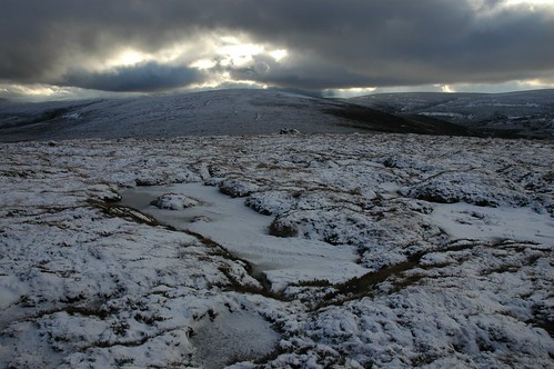
Clouds over the Cairngorms
Firm snow layered over the more peaty sections made for good going but occasional thin ice encrusted sections enlivened proceedings as I broke through and was unsure of what lay beneath. A series of wooden fence posts now provided a guide as they intermittently marked the route to the top.
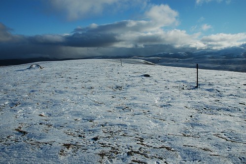
Looking east along Geal Charn's ridge
It was at this point that I discovered that my map was missing, I had it wedged between camera case and chest but now it was gone. If it had fallen recently then it had probably been carried a long way off by the strong wind. I retraced my steps anyway for about 300m but had no luck finding it. I was a bit annoyed with myself, it had dropped a couple of times already but being in its waterproof case I had felt it go. I turned my attention back toward the summit and was soon standing at the cairn.

Southern Cairngorms from Geal Charn
The sun was out but the strong breeze ensured it had little effect on the sub zero temperatures. I had watched the dark clouds dancing over the main Cairngorm peaks with Ben Avon and Beinn a'Bhuird in particular only making a partial appearance. I was intending to head off the hill by taking the northern spur but decided that I would retrace my route onto the hill; just in case I could spot my map. The summit section of the ridge I assume to be covered in dwarf plants or at least finely cropped vegetation as provided a wonderfully cushioned snowy walkway. Back on the road below the hill I had failed to find the map but continued on my way down toward Dorback lodge. I stopped for a bite to eat and when putting my rucksack down by a boulder discovered a partially snow and ice encrusted scarf. The scarf was quite a nice one, funny how it sometimes happens that you lose one thing the find another. A small plantation near the lodge signalled a branch in the track that would take me up toward the cottage at Fae. The cottage looked well maintained and had an unusual thatched porch on the side. A little further on was the remains of another building, there seemed to be a large number of ruins dotted throughout the area.
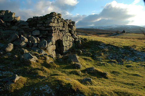
Ruin at Fae with Geal Charn in the background
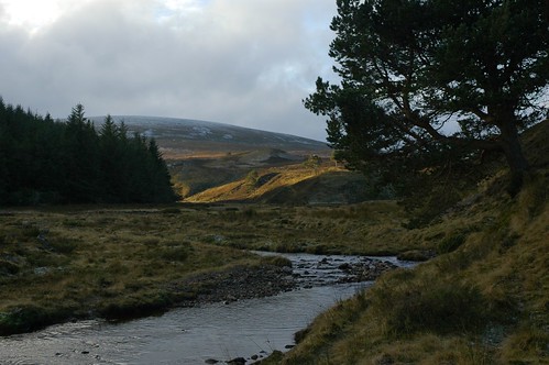
Leaving the track that headed up hill toward another dwelling I headed over some flatter ground before descending into the lovely Glen in which Allt Lomadaidh runs. The darker clouds that had threatened to catch up with me for the last few hours now released a fine drizzle which turned to light snow shower.
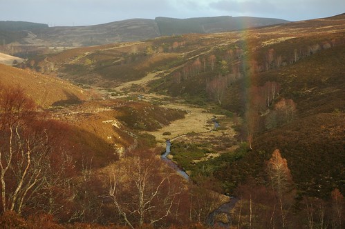
Allt Tomadaidh
The path contoured along the lower hillside just above the river dropping once to ford a small tributary. A small group of Roe deer scampered up the hillside in the gathering gloom that was partially coloured by a feint rainbow. I emerged on the road above the Bridge of Brown Tearooms which being out of season were unfortunately closed. After a short walk along the road and over the bridge of Brown I was soon back at the van and in plenty of time to visit my very own tea room in the back.
Top Of Page
site info
© 2007-2008 Paul Sammonds. Template Design by Andreas Viklund.