Footprints Across Scotland
Why not make a few of your own!
1st to 3rd September 2014
A challenging three day backpack through Galloway Forest Park.
Route Map
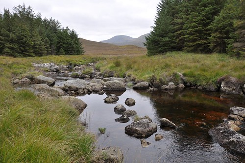
After negotiating the twisty windy roads from Girvan on the coast as far as Bargrennan I headed along the single track into Glen Trool and the depths of the Galloway forest park. It was quite late as I arrived at the large car park a few meters short of Buchan Bridge. My bed was soon readied and I settled down for the evening. After a good breakfast I loaded up with a few days supplies and followed the path north trying to avoid a soaking from the ferns squeezing the path. There was a good volume of water flowing down the Buchan waterfall following on from the previous days downpours with promises wet feet for later in the day.
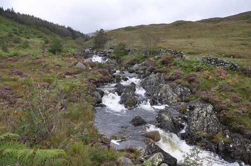
Buchan Burn
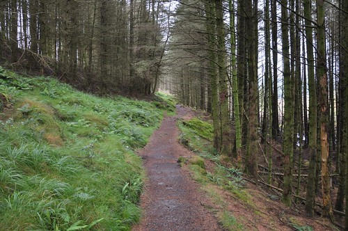
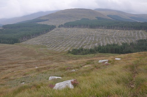
Forest Trial approaching Culsharg
The good path follows the tree line on the edge of a plantation before a raised meadow is reached as the old building at Culsharg comes into view.
Culsharg below Benyellary
After crossing a lumber road I re-entered the pines to follow the Whiteland burn towards the open hillside, the boundary between wood and hill marked by a sculptured stepping stone.
Heading for the hills
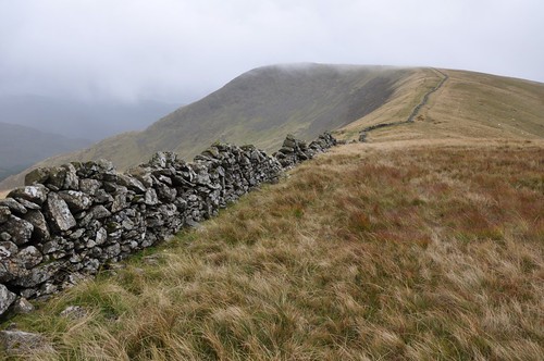
The path rose to the stone wall on the ridgeline which in turn guided the way through the mist to Benyellary. Occasional clearing of the gloom revealed a fine high level pathway across the Neive of the Spit above the Scars of Benyellary.
Benyellary from Neive of the spit
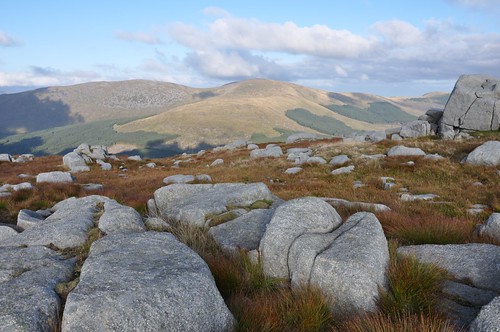
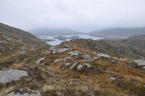
A group of ladies and their canine friends stopped for a wee chat on the broad shoulder of the Merrick but I had the summit and clearing views to myself. A steep but easy drop onto Little Spear was required before I made the col separating Red Glen and Loch Twachtan at the start of the climb onto Kirriereoch Hill. A quick survey of the land to the north indicated that I would need to weave my way around a myriad of small lochans while negotiating plenty of boggy ground and would do well to avoid the promised wet feet.
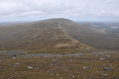
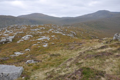
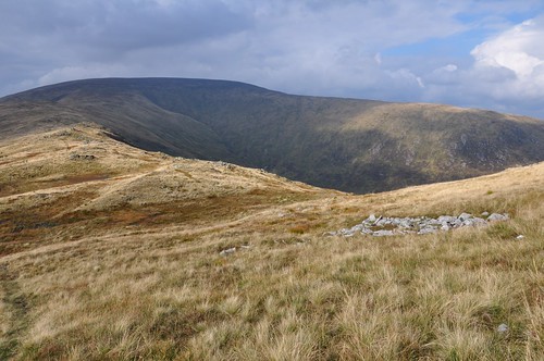
Tarfessock & Shalloch of Minnoch
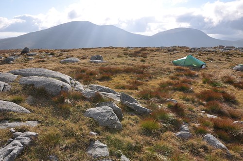
The undulations continued after Taressock as another drop to Nick of Carlach was required before a final pull onto Shalloch on Minnoch. The summit overlooks Maidens Bed to the east while the trig point lies on a boulder strewn top north west across a shallow dip. This grassy hollow offered up a good place to pitch the tent providing reasonable shelter from the stiff breeze.
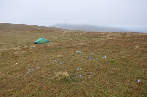
Camp, Shalloch on Minnoch
After a quite night I awoke to a misty and rather hazy start. I wandered back over to the summit and followed the ridgeline north passing over The Cargaie. The general idea for the day was to work my way over toward the Corserine ridge, what followed over the next few hours was very testing to say the least. My high viewpoint suggested that a route east through some of the fire breaks may provide reasonable going. After easing around Carglas Craig I began my descent heading for the point where Craigencoof burn met the forestry track.
Dropping to Big Meowl
The vegetation grew as I dropped and a mix of heather and shrub tangled with my legs as I fought my way to the road. The forest had been cleared here and I started along the old firebreak. A little uneven, the ground I covered was not too bad until it became more rutted and boggy. Some deeper pools and old tree branches soon made thing more awkward, I considered retreat but thought that maybe things would improve once amongst the trees. Submerged stepping stones eased the crossing of a burn and seeing as my feet were already wet another soaking was not considered a problem. Things eased slightly working through the firebreak through the trees but it was slow progress over the soggy and uneven ground. It was tiring work and by the time I had reached the long branch I was planning on going down I hesitated and considered my options. I decided I need out of the forest and would tackle the open hillsides. Extracting myself from the woods was less easy than hoped but after fording another couple of burns I managed the forest edge.
Exit left
I had spied a few deer that seemed to have a number of walkways through the trees and thankfully their tracks on leaving the forest ran out onto the open moor in the general direction I intended to take. The narrow defile laid down by the passage of the deer was deep and the heather and scrub over hanging, it was more hard work. I needed to gain some height so headed south and onto Macaterick. The vegetation deepened again and I found myself wading through it, knee high over more uneven ground. It was hard to settle into any kind of pace and keep balance as my walking poles continually became snagged in the undergrowth.
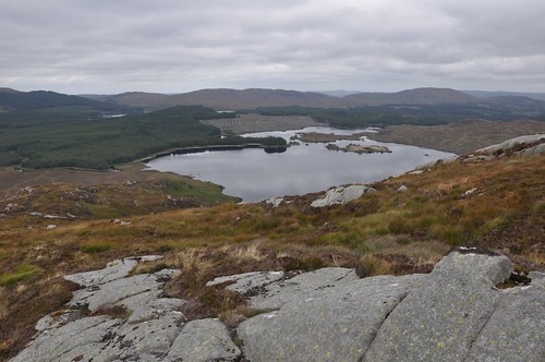
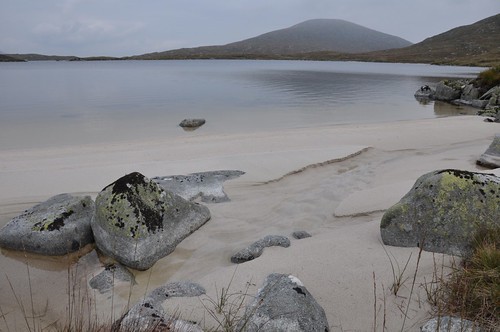
Loch Macaterick
Eventually I reached the top Macaterick about 3km as the crow files east of Shalloch on Minnoch and it had probably taken me three hours. I needed a good break so got my stove out to make some soup while I had a bite to eat.
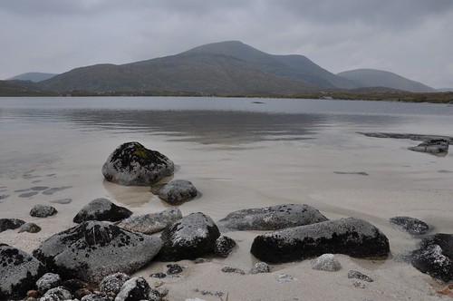
Merrick from Macaterick
Continuing south I followed the ridgeline toward the Rig of Millmore over easier but never less rough ground. Maintaining height I contoured round the hillside crossing Saugh Burn before battling through the undergrowth again to reach Rig of Munshalloch.
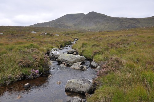
Merrick & the Saugh Burn
I now headed up toward Loch Enoch, which I had hoped to explore during my trip. First though I decided to visit the top of Mullwharchar and began an ascent of the south east ridge from the bealach. I was delighted to discover that the summit area opened up some good spots for pitching the tent, and so despite it being quite early I decided it was time to call it a day, and a tough day at that! Tent up I wandered off in search of a pool to wash away the tiredness.
Merrick from camp on Mullwharchar
Suitably refreshed I was soon sitting with a brew enjoying the brightening outlook albeit with views that were stall a bit hazy.
Corserine from Mullwharchar
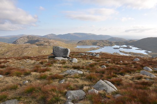
Loch Enoch from Mullwharchar
Later in the evening the mist rolled in again and stubbornly refused to move until well after dawn. I dropped out of the gloom to reach the shore of Loch Enoch. I decided to explore the shoreline a wee bit and circumnavigate the loch with a slight detour to see if I could find the Grey Man of Merrick. It was pleasant enough wandering along the waters edge but a drop of sunshine would have made so much difference. I left the loch side to climb up and over the bealach between Redstone Rig and Craig Neldricken, dropping down the other side to find the Grey Man off to my right. The face in the rock near the base of Merricks south east ridge is quite striking and was definitely worth seeking out.
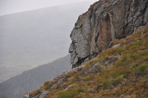
The Grey Man of Merrick
From here I retraced my steps before climbing onto the nobly ridge leading to Craig Neldrickens west top and took the high ground over the main top before heading for the loch shore again a little west of Craignairny.
Loch Enoch from Craig Neldricken
Mullwharchar from loch Enoch
Merrick from loch Enoch
As I turned the hill a movement on the slopes caught my eye, at first I thought it was a small group of deer but as I got a little closer I realized they were wild goats.
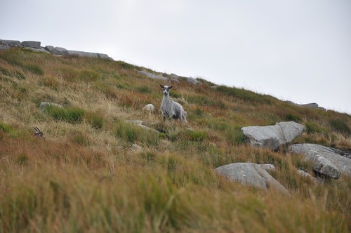
Feral Goat
Picking up a path or deer track I following the line of the Pulskaig burn to the Grassy flats of Gala Lane. From my overnight vantage point I had noticed that the west ridge of Corserine was accessible through the gaps left in the plantation after tree felling operations.
Mickle Craigtarson leading to Corserine
A bit of clambering about was required but I soon made the grassier slopes of Meikle Craigtarson. The steepness eased over a more level section of ridge before the final pull up to the summit. After a wander a bit further east to ensure Id reached the top I turned down the southern ridge to begin the start of what was going to be a very long walk back to the van. The ridge at this point gave the easiest going of the trip and I was soon crossing the narrows of Millfire before ascending Milldown.
Corserine from Milldown
Continuing along the Rhinnes of Kells I made a stop at Meikle Millyea for a bite to eat and to way up route options.
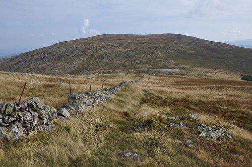
Meikle Millyea
I considered trying to drop down to a forest track to the west but in the end thought Id continue along the ridge over Little Millyea and pick up a short fire break south of Darrou.
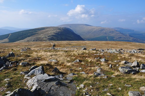
Corserine & Milldown from Meikle Millyea
Unfortunately, I was soon back on really rough ground again and it was quite wearying working round Darrou. It was hard to pick out the fire break but after battling though lengthening bracken I eventually entered. The deep vegetation was combined with boggy underfoot conditions but I didnt feel I had an alternative. To say I was a bit dismayed would be an understatement, the fire break closed in and my way looked to be blocked by fallen trees. Fortunately the gaps in the trees to one side were wide enough to ease through and I mercifully reached the forest track and the Southern Upland way feeling very relieved indeed. After re-checking the map all that was now left was to steal myself for the 7 mile walk along the southern upland way back to the van!
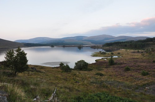
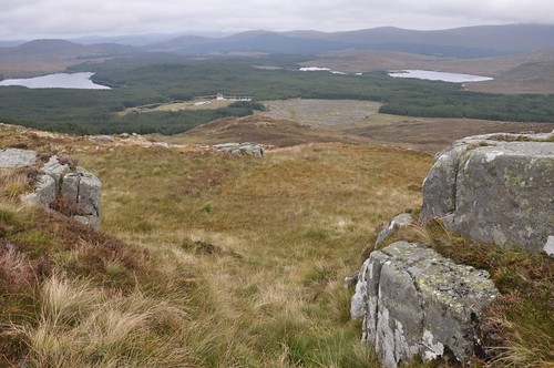
Loch Dee
It had been an interesting trip, quite frustrating at times but enjoyable all the same.
Top Of Page
site info
© 2007-2008 Paul Sammonds. Template Design by Andreas Viklund.