Footprints Across Scotland
Why not make a few of your own!
8th & 9th June 2013
A visit to Horse hill starting in the delightful Glen Artney with a return over Stuc ' Chroin and Ben Vorlich.
Route Map
Beinn Each lies on the western side of a horse-shoe of hills that form the headwall of Gleann a' Chroin. Beinn Each is connected to Stuc a Chroin via Bealach nan Cabar and forms the highest point of an undulating ridge that tends south from the Munro towards Callander. The two summits can be climbed via Glen Ample starting from the shores of Loch Lubnaig but I had in mind a longer excursion that would include Beinn Vorlich and an overnight camp. Stopping in Crieff for provisions I was directed to Campbells bakery for freshly made sandwiches and a couple of irresistible pies. Hunger satisfied and thirst quenched I set off for Glen Artney and enjoyed the drive along the narrow road way to stop at the walkers car park opposite Glenartney Church. Food added to pack and I was away down the final short stretch of tarmac toward Auchinner and Glenartney Lodge.
Auchinner
A guy resting against a dry stone wall was waiting for the return of the lads of the boys brigade who were out exercising on the hills somewhere. Im not sure if our conversation distracted me but I headed around the lodge and after passing through sheep pasture took to the steep slopes leading onto the ridge.
Meall Clachach
Topping out I surveyed the landscape and picked out the ragged face of Stuc a Chroin.
Distant Stuc a' Chroin and Ben Vorlich
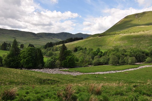
It appeared to be in the wrong place! It soon dawned on me that I turned off the main track to quickly and had not followed my intended route. I was on Carn Lubhruinn, thinking what to do from here I contemplated adding Meall na Fearna and doing my round in an anti-clockwise direction. Going this way around I didnt think I would find a suitable campsite until Stuc a Chroin and that was a long way off. I decided it best to get back on track, so to speak. I headed off losing the 200m of height I gained and dropped into, then out of, Glennan Dubh Choirein before making my way to Arivurichardich. As I progressed south of Tom Odhar a Red Kite emerged from the deep gasses nearby and soared into the evening sky. I would see another (or maybe the same one) a little later on when eventually on the right ridge. The path took me onward and after leaving the locked bothy at Arivurichardich behind I turned into Gleann a Chroin with its small Reservoir.
Arivurichardich
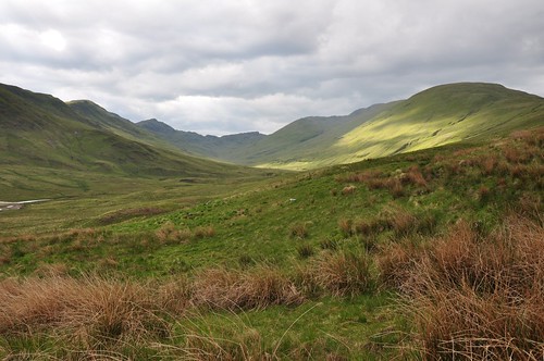
Glenn a' Chroin
After surveying the hillside opposite I crossed the burn and took a line up beside Sgiath an Dobhrainn and gained height fairly quickly.
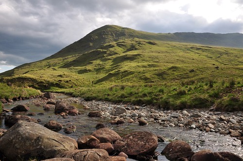
Sgiath an Dobhrain
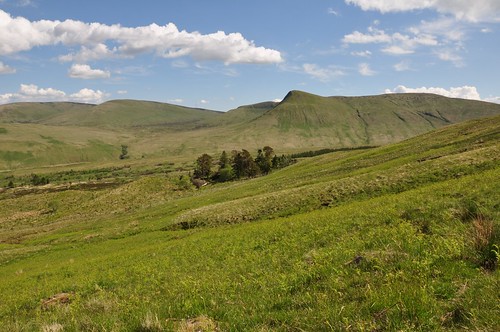
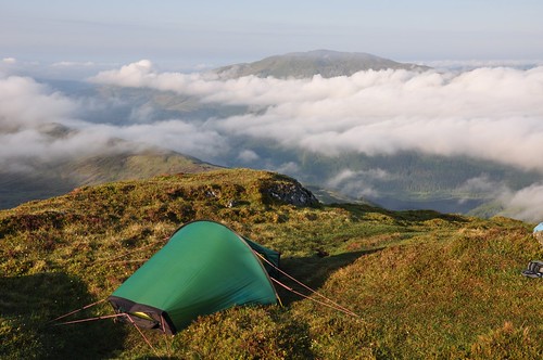
The sky threatened rain but also splashed sunlight across the Glen illuminating the slopes and bring a little warmth to the surroundings. Working along the ridge I continued to gain height, albeit a little more slowly, to reach Meall na Caora before the final stretch up to the top of Beinn Each. I was a bit light on water and it looked like this may thwart my plans to camp on Beinn Each. The next obvious water stop on the map looked to be the burn feeding the Lochan nestled a little below the summit Stuc a Chroin. However as it turned out my luck was in! Im still unsure of how and why they came to be there, but I found a stash of two packs of about a dozen bottles of water. The packs were open and some of the bottles empty; it wouldnt be long if the wind got up before they were strewn over the hillside.
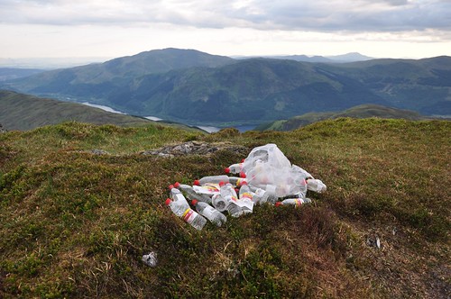
Water cache
Having tidied up the cache I removed the empties and packaging and stashed them in my rucksack. I would leave the remaining full bottles for future visitors to the top, hoping that they would at least take away the empties after drinking the contents. Water shortage dilemma over it was time to make camp, fortunately there proved to be just enough room on the small summit area to squeeze my tent in. Erected in time I was able to shelter from a couple of heavy showers before the skies partially cleared later on.
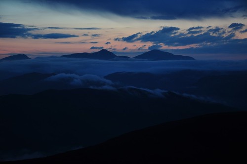
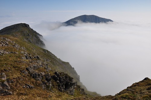
Stob Binnien and Ben More
The morning broke clear with an inversion layering the Glen floor and mist covering all but the highest peaks.
Ben Ledi from Beinn Each
After a leisurely start I made my way across the knobbly Bealach nan Cabar with the mist toing and froing as I went.
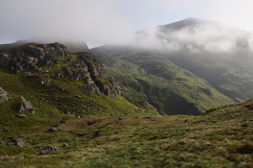
Stuc a' Chroin from Bealach nan Cabar
During the climb up Stuc a Chroin the hillside remained cloaked in grey until I again emerged into the sunlight just before the summit.
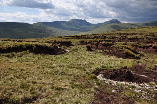
Ben Vorlich from Stuc a' Chroin
The mist didnt look like clearing but I enjoyed an early lunch to give it some time. The short narrow summit ridgeline of Ben Vorlich was just visible and I could just make out the occasional walker as I sunbathed in solitude. Eventually it was time to move and negotiate the steep rocky face below Stuc a Chroins northern top to gain Bealach an Dubh Choireinn. I crossed paths with some fellow walkers as we negotiated our way to opposite summits. The mist on the top was thin but it never cleared enough to get a good view of the cloudless sky. Stove out I enjoyed a brew before following Ben Vorlichs south east ridge into Gleann an Dubh Choireinn. The mist remained stubbornly in place on the higher slopes during my walk out to Auchinner but some nice waterfalls and carpets of bluebells brightened the lower glen. An impressive gorge offered up some interesting potholes while the sides of the burn encouraged some fine wild flowers.
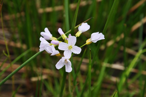
Alpine Lady's Smock
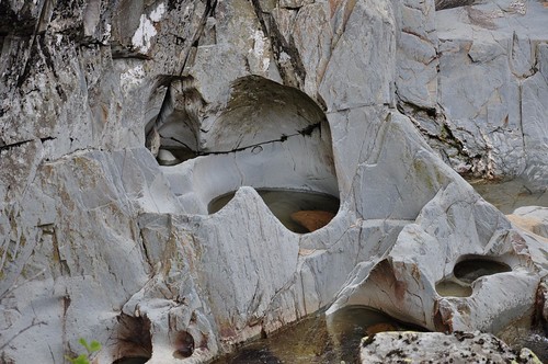
River Pothole
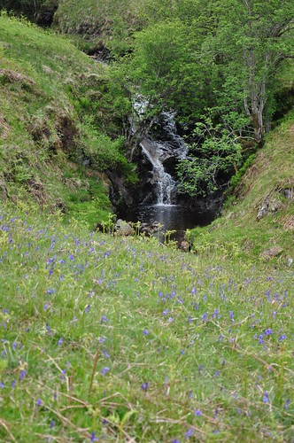
Waterfall, Allt an Dubh Choirein
At Aucinner I decided to follow the path along the north side of the water of Ruchill. A gate in the deer fence allowed access to a field roughly opposite the church and allowed me to eventually drop to the riverside. The waters were low but I had thought I would need to paddle across at some point as the waters are quite wide; but as it was I managed to pick up enough stepping stones to gain the opposite bank without wetting my feet. Although a paddle in the river at this point would have been quite a pleasant way to end what had been another fine weekend outing.
Top Of Page
site info
© 2007-2008 Paul Sammonds. Template Design by Andreas Viklund.