Footprints Across Scotland
Why not make a few of your own!
31st May to 3rd June 2008
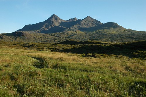
A few days exploring the corries and peaks of the Black Cuillin of Skye
Glen Brittle would be my base for the first two days, braving the midges at the
campsite on the shores of Loch Brittle. After an early start and good run out
from Aberdeen I was ready to strike out for the Cuillin ridge by 11am Saturday
morning. The bright sunshine in upper Glen Sheil had become masked by mist then
sea harr as I worked my way through Kintail to Kyle of Lochalsh and across the
bridge to Skye. Patches of blue poked through as I turned off the main road to
Portree at Sligachan.
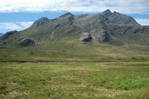
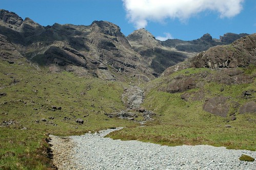
After parking near the youth hostel I weaved my way along the path that snakes past some small waterfalls into
Coire a' Ghreadaidh. The greens of the lower reaches were replaced by stone
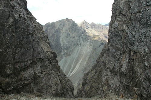
slabs and the many boulders and rocks that line the corrie of An Dorus.
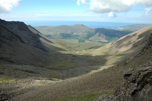
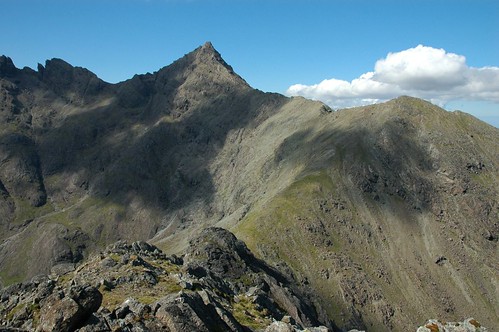
Coire a' Ghreadaidh and Glen Brittle
I headed for the low point of the ridge that connects Sgurr Thuilm and Sgurr a' Mhadaidh. The narrow crest leading to the top of Sgurr Thuilm looked inviting so I detoured out to take in the views from its top.
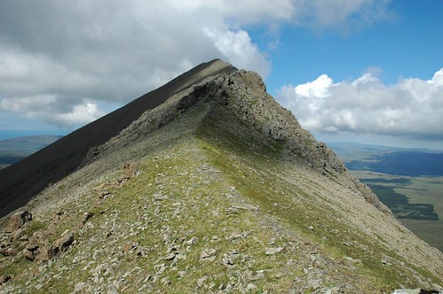
Narrow crest up to Sgurr Thuilm
The sun was now cracking the flags so it was time to apply the sun cream. After returning to the col it was now a steep climb and scramble up the steep buttress on the west side of Sgurr a' Mhadaidh.
Sgurr a' Mhadaidh
There was limited space on the final narrow summit ridge, just enough for me and a group of exchange students out experiencing the hills.
Sgurr a' Ghreadaidh from Sgurr a' Mhadaidh
A steep drop to the south had to be entertained to reach the An Dorus gap. A more gradual ascent lead up onto Sgurr a' Ghreadaidh negotiating the gap at Eag Dubh and passing a large rocky pillar called the "Wart". Loch Coruisk appeared over to the east cradled by mountains on either side.
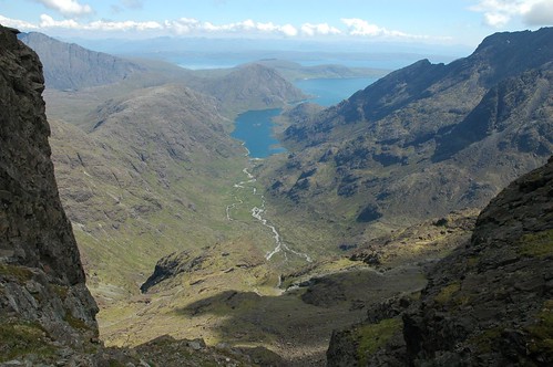
Loch Coruisk
Sgurr Thuilm was basking in the sun to the north west.

Sgurr Thuilm
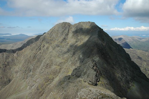
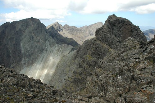
The top of Sgurr a' Ghreadaidh forms a knife edge of a ridge and the continuation to the south top has intimidating drops on both sides. Another steep rocky descent brought me to the col before Sgurr Thormaid. A number of rock pinnacles were passed on the final climb of the day to reach the summit of Sgurr na Banachdich, which was a bit more rounded to the west but with a typical Cuillin drop to the east.
Sgurr a' Ghreadaidh from Sgurr na Banachdich
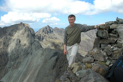
A long lunch stop was enjoyed here watching a steady procession of silhouettes negotiating the Inaccessible Pinnacle to the south.

Sgurr Alasdair and Sgurr Dearg from Sgurr na Banachdich
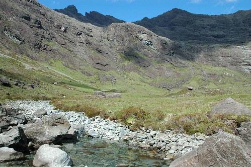
All that was left now was to drop towards Coire an Eich and regain the outward path next to Allt a'Choir Ghreadaidh.
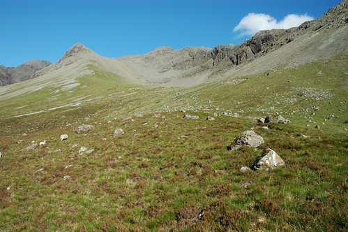
An Diallaid and Coire an Eich
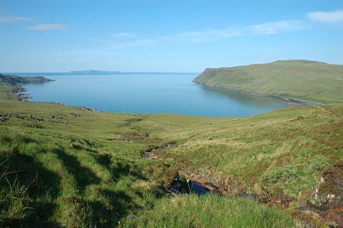
Back at the campsite there was just time to enjoy a shower and a bite to eat before the wind died and the midges appeared in force. The campsite was next to the sea so I took a stroll down to the beach as dusk approached.
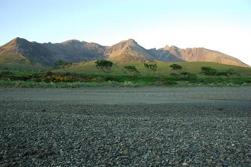
Dusk over Glen Brittle and the Cuillin
The new day dawned bright and clear so I was ready to head off handy but hung back 'till 8.30 to pay my site fee's and get some milk from the camp shop.
Loch Brittle becalmed
I was soon making my way over the grassy hillsides passing Loch an Fhir-bhallaich on my way to Coire Lagan.
Sgurr Dearg and Coire Lagan
A path over to the right of Coire Lagan passes under the cliffs of Sron na Ciche and the hanging rock of The Cioch. Climbing and clambering over many large rocks for much of the way certainly raised the pulse rate. The high cliffs gave shaded relief from the warm morning sun until I gained bealach Coir'a Ghrunnda.
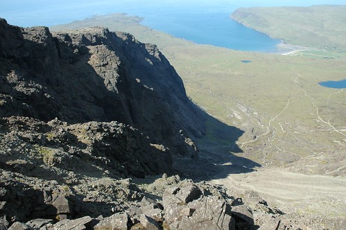
Looking down the lower reaches of Coire Lagan
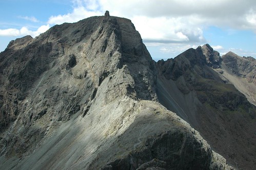
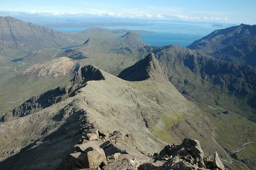
The bealach gave the first glimpse of the Loch of the same name and the southern reaches of the Cuillen ridge. Continued rock climbing and a faint path lead up onto Sgurr Sgumain to give immense views across Coire Lagan to Sgurr Dearg the Inn' Pinn' and the Northern end of the Cuillins.
Sgurr Dearg and Coire Lagan
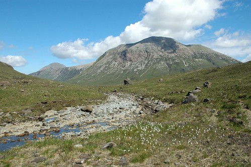
A traverse along a narrow path and some tricky manoeuvres led to the top of the Cuillins highest peak, Sgurr Alasdair. The pointed summit provided a great panorama of vertigo inducing views.
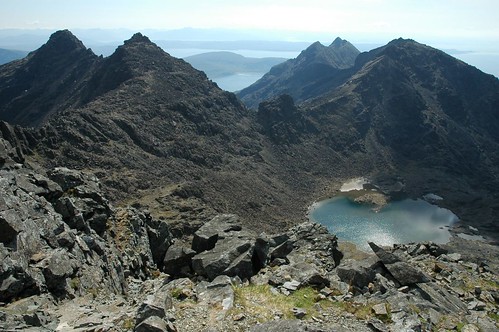
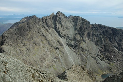
Sgurr Dubh Mor, distant Gars Bheinn and Sgurr nan Eag
While re-fuelling and enjoying some tea I surveyed the route ahead with a little trepidation, it looked a bit tricky to say the least.

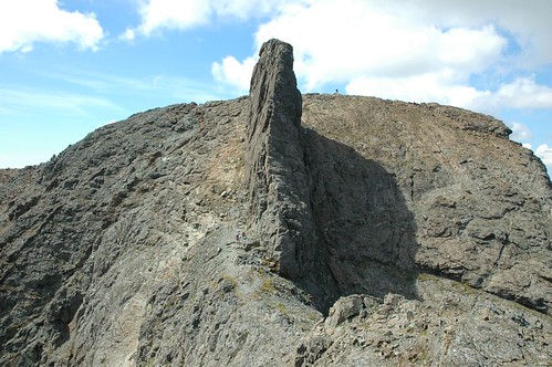
Sgurr Dearg and the Inaccessible Pinnacle
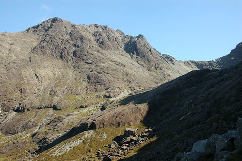
The first job was to get down to the head of the great stone shute, an impressive scree run that drops a very long way down into the heart of Coire Lagan.
Sgurr Dearg from the top of the great stone shute
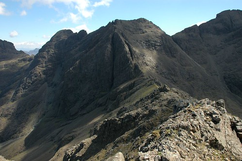
After gaining the top of Sgurr Thearlaich its narrow crest sloped down gently, at first, toward Sgurr Mhic Coinnich. A narrow gap was passed before a steep and awkward descent to bealach Mhic Coinnich. A huge tower of rock appeared to block the way, but a short scramble saw me gain the start of Collie's ledge.
Sgurr Mhic Choinnich, Collies ledge and Sgurr Dearg
This narrow ledge traverses round to regain the ridge line after about 100m, intimidating drops away into coire Lagan on the left give a very airy feel to this short section of the walk. Reversing direction but this time upwards saw me reach the top of Sgurr Mhic Choinnich.
On top of Sgurr Mhic Choinnich
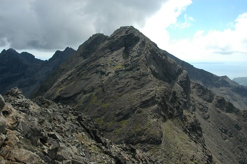
Continuing north now along the ridge I was soon faced with the dilemma of whether to climb An Stac directly or skirt around it to reach the base of the Inaccessible Pinnacle.
The route up to the Inaccessible Pinnacle
An Stac provides steep but easy climbing with the realisation that once committed there was no turning back, the only way to go was up! Emerging just north of the top I was brought face to face with the intimidating sight of the Inaccessible Pinnacle.
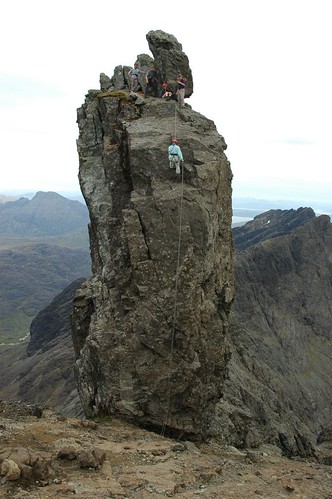
Inaccessible Pinnacle
The Inaccessible Pinnacle forms a narrow fin of rock that sits on the side of Sgurr Dearg, its top protruding above the main bulk of Sgurr Dearg and so making it the true summit. The usual way up is to climb the narrow crest on the east side and then abseil off the west. For me to do the climb would require help from someone with a bit of experience and the gear to abseil off. I arrived as a group of three were roping up for their ascent. I dropped to the base of the Inn' Pinn' as Neil was part way up. I was chatting to his wife Claire and their friend Victoria as Neil set himself at a belay position half way up. My luck was In, Claire enquired if I was going up and after saying I would like to and a quick conference with Neil all was set. He could help me off if I made my own way up. I felt confident to start with after my climb up An Stac, but a while standing there watching Claire and Victoria follow Neil and studying the surrounding I must admit to being a bit nervous. Once they had cleared the half way point I set about my ascent with not to much difficulty, just one tricky spot about half way.

The Inaccessible Pinnacle; going up
The Inaccessible Pinnacle; coming down
I just focused on the task in hand, placing my hands and feet as firmly as possible and tried to avoid looking at the sheer drops on either side. On top I snatched a quick couple of photo's before Neil suggested I descend first. Putting on his harness I enquired "was it a good time to tell him that I hadn't abseiled before". After brief instruction I backed away from the top and dropped over the edge of the west face. I was down all too soon just as I was beginning to enjoy the experience.
Sgurr Alasdair and the great stone shute
After all the excitement it was nice to sit down enjoy the surrounds and a leisurely lunch. As I left the top the guy who I'd seen on Sgurr Alasdair and who had taken my photo on Sgurr Mhic Coinnich appeared at the base of the Inn' Pinn'. He was with the two climbing friends he was waiting for when I'd left him earlier. I watched for a while as they also started their ascent. I then followed the ridge down to Sgurr Beag and then on into Coire na Banachdich past the waterfalls further down. I emerged at the roadside near the Glen Brittle hut and from here it was a short walk back to the campsite. Again the breeze kept the midges at bay until around 8.30 when it was time to retreat to the car to read and then watch as the sun went down.
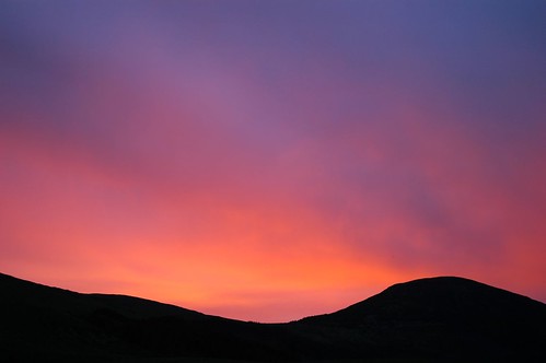
Glen Brittle Sunset
The following morning arrived slightly misty and a bit damp after overnight rain. Distant blue on the horizon was eating away slowly at the grey skies giving hope for another good day. I dismantled the tent and headed off to Sligachan where it was quickly reassembled. I was soon leaving the campsite and heading up Glen Sligachan on the path for Loch Coruisk.
Sgurr na h-Uamha, Sgurr Beg and Sgurr nan Gillean
The skies continued to clear and around midday there was little evidence of the earlier cloud. I walked a good distance up the glen until I reached Lochan Dubha where I followed the river on its course around to the west. I picked up another path near the river bank and this lead into Harta Corrie. There wasn't a lot of water flowing but it meandered through many clear river bed pools. The smooth stone basins in the river were giving off inviting cool blue reflections.
Harta Corrie from Glen Sligachan
I now came upon the Bloody stone, a huge boulder that stands out in the wide corrire from afar. Harta Corrie is the site of the last clan battle between the MacDonald's and MacLeod's in 1601. It is said that the bodies of the slain were piled round the base of this huge rock, now known as the 'Bloody Stone'.
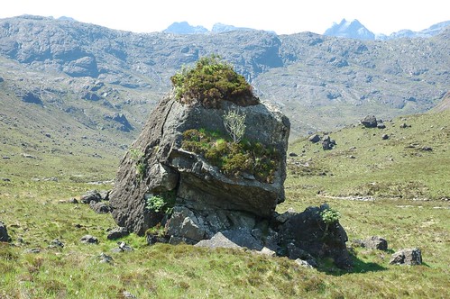
The Bloody Stone
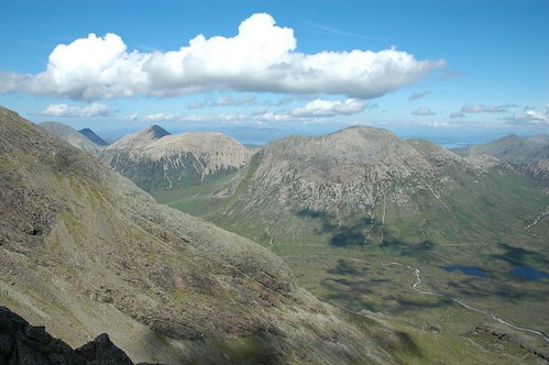
Looking back toward Glen Sligachan there where fine views of Marsco.
Marsco
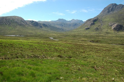
I continued to follow river Sligachan as it wound its way round towards Lota Corrie.
Harta Corrie leading into Lota Corrie
I stopped to replenish my water supplies and the temptation to take a dip was too much. I could have stopped there all day, sitting in the sunshine drying off after an invigorating immersion in the cool waters.
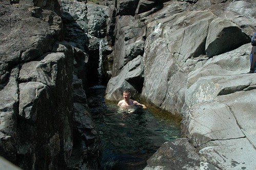
Time to cool off
I managed to drag myself away and progressed on into Harta corrie, impressive rock faces all round towered up toward the Cuillin ridge above. I followed the partly dry cascades in my initial ascent, passing with hesitation some more inviting pools.
Lota Corrie
Leaving the river course and using the rocky slabs that lined the hillside I was soon at Bealach a' Ghlas Choire, just south of Sgurr Beag. My approach route through Glen Sligachan was now set out below me with Marsco and the other red Cuillin beyond.
Marsco and other Red Cuillin
The conical peak of Sgurr nan Gillean's could be seen pointing skyward along the ridge from Sgurr Beag, It would need to wait a little longer as I first headed out in the opposite direction to climb Sgurr na h-Uamha. I eventually found a way up after careful negotiation of some high level grassy tiers.
Am Basteir, Sgurr nan Gillean and Sgurr Beag
I retraced my steps to the bealach using one or two stones I had laid as route markers. The route along from Sgurr na h-Uamha to Sgurr Beag had some grass cover, something of a rarity along the Cuillin ridge.

Final Summit, Sgurr nan Gillean
I was joined by another walker during my lunch stop on Sgurr Beag, he was also enjoying the fine scenery in the sunshine. It was now time for the challenging ascent of Sgurr nan Gillean, a steep route of rocky slabs and boulders. The good weather allowed walking along the narrow edges that would have been a very different proposition in adverse conditions.
The ridge down from Sgurr nan Gillean to Sgurr Beag and Sgurr na h-Uamha
Another small but fine airy summit opened a wide vista from the mainland to the other islands out to sea. After finishing my flask it was time to carefully tackle the descent back to Sligachan.

Marsco
There was just time to get a shower before making the last of the meal orders at the Sligachan hotel. A welcome pint washed down a tasty venison casserole before re-tiring to the tent and a good nights sleep.
Final view, Sgurr nan Gillean and Am Bastier
Wind and rain ruffled the tent over night but I arose to another dry day. After packing up I headed off the island taking a side trip to visit Plockton on my way back to Aberdeen. At lunchtime the weather had brightened sufficiently for me to enjoy a bag of fish and chips on the sea front and look back on a great few days walking.

Plockton sea front
Top Of Page
site info
© 2007-2008 Paul Sammonds. Template Design by Andreas Viklund.