Footprints Across Scotland
Why not make a few of your own!
28th February & 1st March 2014
A Winter backpack over An Sgarsoch and Carn an Fhidhleir (Carn Ealar)
Route Map
After a fairly sunny drive down to the Linn of Dee near Braemar the weather seemed to be turning as I followed the banks of the River Dee up to White Bridge.
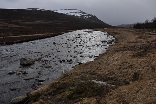
River Dee and Meall Tionail
While taking a snack break I took the opportunity to done waterproofs to guard against the sleety rain drifting down the glen before taking the route south toward Glen Tilt. On reaching a point where the river cuts across the track I think I was too preoccupied with how to cross the river that I didnt check whether I actually needed to! There was no way to cross dry-shod so it was with boots tied to rucksack that I immersed feet into the cold icy flow. The cold only really hit about half way across but there was no potential for rushing, so with teeth gritted I continued my steady progress and made for the far bank. Towel out and feet dried the warmth soon returned and the journey continued. On reaching the ruins of Bynack lodge I had a hazy recollection that I was on the right track, however on checking the map I soon realised that my turning was back before my river crossing.
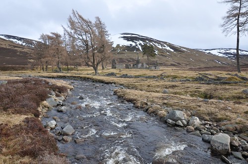
Bynack Lodge
I weighed up my options, retrace my steps and re-cross the river, brrrr, no thanks. Cross some lower hills to regain the track? Nope, I decided to follow the Bynack Burn into Coire Chuil and take it from there. My original and rather ambitious plan was to climb Beinn Bhreac and then start a walk back the following day over Carn Ealer and beyond before and dropping down to the ruins I had just left. Going this way afforded the opportunity to do the same route but in reverse. Keeping close to the burn the ground was not too rough but soon the river began a rather meandering course up through the glen. Peat hags and deepening snow made for slow progress and the light was starting to fade as I approached the head of the corrie. I wanted to camp high if possible and felt I still had time before nightfall so started up the steep slopes toward the ridgeline.
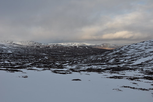
Coire Chuil and the Bynack Burn
On making the ridge I began scouting about for a suitable spot to camp. Higher up the snow had partly blown from the vegetation and this seemed a reasonable option but in the end I decided on a slightly less exposed position in a snow filled shallow depression a little lower down. The snow was hard packed and the tent pegs felt secure to sideways movement despite them pushing in very easily. I then employed my ice axe and walking poles as anchors for extra security.
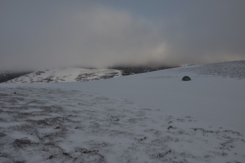
Camp near Coire na Creige
Camp set I gathered some snow to melt and prepared a brew before enjoying my evening meal. The views from the ridge had been fleeting and the mist had descended more deeply with the dark. Ive no idea what the temperatures were overnight but I was glad Id invested in a new winter sleeping bag which kept me cocooned nice and warm. The mist was still lingering in the morning but did show some signs of shifting and I thought I could detect shades of blue above the ceiling, or was that just wishful thinking? If nothing else I had a good session of map and compass work as I made my way over the generally firm snow that covered the ridge. The mist embed and flowed shortening and lengthening visibility over the next couple of hours. It was a bracing walk with the stiff breeze but despite the lack of views I was quite enjoying the experience. As I approached the final rise from the col just before An Sgarsoch a feathery white crescent illuminated the sky in front of me. For a good few moments I couldnt fathom out exactly what I was seeing, the rounded top edge seemed a little too perfect for a cloud, but just what was it? Finally, as the view expanded, it dawned on me just what I was seeing; it was the sun illuminating the snow on the upper slopes and rounded summit of An Sgarsoch.
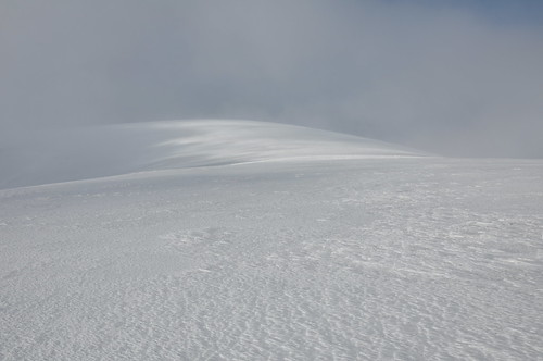
An Sgarsoch appears out of the mist
I stopped for a while as a pocket in the mist allowed me to gaze at the white wonderland of the world surrounding me. Eventually I started forward again and soon reached the top with the views again retreating. I examined the map and prepared a compass bearing for the way down as there seemed little point in continuing to the next summit with the limited visibility. Another break though, revealed Carn Ealar (Carn an Fhidhlier) and I headed down the slope towards it to get a photograph.

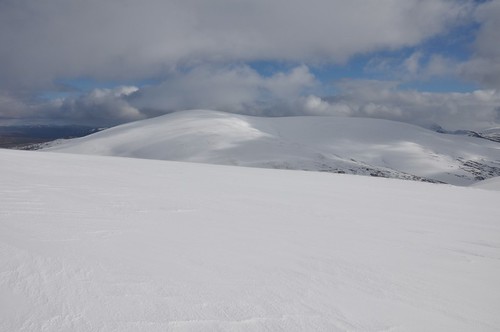
Carn an Fhidhleir (Carn Ealar) from An Sgarsoch
Maybe I would continue down to the bealach and head out that way or if things improved then maybe I would continue to the next hill?
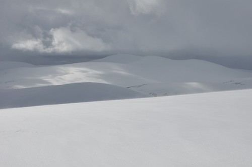
South ridge of Carn Ealar from An Sgarsoch
Onward and downward to the bealach it was. The snow was soft and deep around the bealach but firmed as I got onto the steeper slopes on the other side. It was a bit stop start as I hauled myself onto the ridge proper at which point I was enveloped in a world of grey. Another map and compass check made sure that I was aligned for the final pull to the top. And then, as the sun broke through a gap in the clouds, the summit was illuminated in the distance like a bright white beacon in a sea of grey.
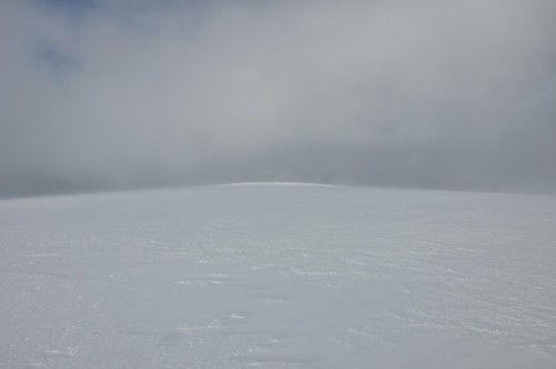
Sunlit Summit of Carn Ealar
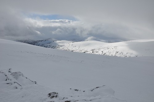
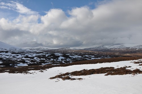
The hills to the south where plastered in snow and the whiteness was only blemished by the shadows cast by dark clouds racing across the sky.
Braigh Sron Ghorm
The upper slopes were swept by chilling spindrift and there was no shelter afforded by the small summit cairn.
An Sgarsoch from Carn Ealar
I did linger for a little while enjoying the scene before the oncoming chill had me moving again and descending from the hill.
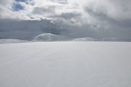
Beinn Dearg from Carn Ealar
Any thoughts of continuing on to Beinn Bhreac were put firmly out of my mind as I followed the long curved ridge downward. I steered clear of the crags on my right before heading over thankfully firm snow fields to eventually locate the path on the opposite side of Allt a Chaorainn.
Glenfeshie Forest
The path eased the way but was occasionally obscured by snow drifts as I made for Geldie lodge.
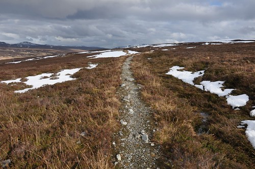
Heading to Geldie Lodge
After fording the Geldie burn I decided it was time for some hot soup and a bite to eat in preparation for the remainder of what is a very long walk out.
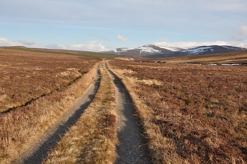
Track alongside the Geldie Burn
I eventually and thankfully made the car park as the light faded, tired but happy after a couple of fine days in the hills.
Top Of Page
site info
© 2007-2008 Paul Sammonds. Template Design by Andreas Viklund.