Footprints Across Scotland
Why not make a few of your own!
8th to 15th December 2007
A week in Wester Ross centered in Badachro on the shores of Loch Gairloch
Home for the week would be Creel cabin on Dry island in Badachro bay. The cabin and the house on the small island are owned by Ian McWhinney and his wife Jess. Ian has lived here all his life and continues working in the long family fishing tradition.
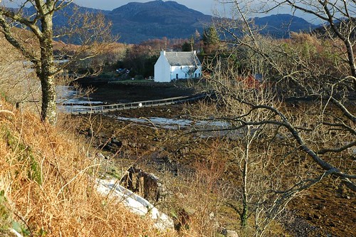
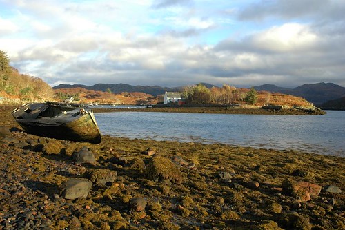
House in the bay
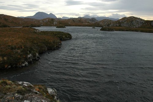
The cabin had a great view across the bay and all the way to peaks of Baosbhienn in the distance.
View across the bay
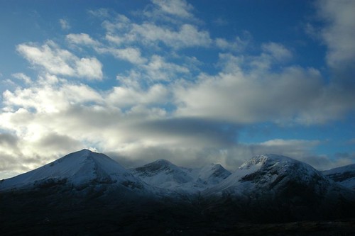
The rain died away by lunchtime on Sunday so I ventured out taking the small trip to Charlestown. Leaving the car near the Old Inn I followed the way marked path up past Flowerdale mains to the waterfall that cascades down between the hills Sithean Mor and An Groban my final destination. Following the path up through the trees on the left of the falls eventually lead to Loch Arigh a' Phuill. After climbing over some boggy moor and keeping the steep rocky cliffs on the left a short scramble led me to the top. To the west lay loch Gairloch running out to sea and to the south east the mountains of Torridon. I had just finished lunch when a local guy from Gairloch appeared with his dog, he would be the only other walker I would see all week.
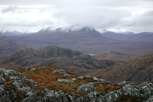
The peaks of Torridon
On Monday I headed back down the length of Loch Maree to climb Meall a' Ghiubhais. I made use of the mountain trail through the Beinn Eighe National Nature Reserve. The path takes a high route and skirts around the steep final slopes of Meall a' Ghiubhais. The impressive bulk of Slioch was ever present over my shoulder as I made my way up through the Caledonian pine.
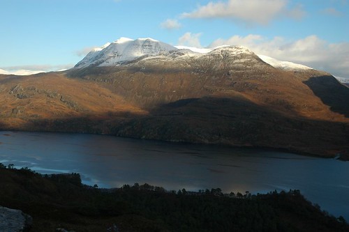
Slioch as seen across loch Maree
As the trail reached its high point a panorama opened up showing the huge Beinn Eighe Massif.
Beinn Eighe under early morning sky
I continued on past Loch Alt An Darich until reaching the shore of Lunar Loch. From here it was a steep pull up snowy slopes to the eastern top then across a mixture of snow and iced rock to the main top. The large cairn provided a good shield from the bitter wind and enabled me to enjoy the views while eating my lunch of soup and sandwiches. The North east slopes were iced and very slippery so I used my crampons to descend to the lochan's below. From here a contour south east saw me pick up the mountain trail again which would lead back down the hillside.
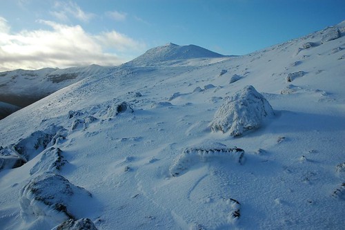
Snowy top of Meall a' Ghiubhais
An early start on Tuesday saw me arrive in Poolewe at around seven. It would be a long walk in, but the first hour and a half would be along a tarmac track. I used my head torch at first before the first grey of morning provided enough illumination to allow me to make my way unaided. The sky reddened dramatically to signal the sun rise proper showing the outline of my main hill for the day, Beinn Airigh Charr.
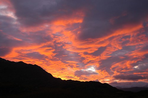
Sunrise over Beinn Airigh Charr
The Torridon hills across loch Maree were also in view by now. A stalkers path helped ease access for most of the way leading up to the col between Spidean nan Clach and Meall Chnaimhean. Passing between these two hills the top of Beinn Airigh Charr came into view. After reaching the summit I dropped slightly north to escape the biting wind and looked down on Fionn Loch and the Letterewe and Fisherfield forest hills. I could see the causeway between Fionn and Dubh lochs and the place were I camped way back at the end of March. I took in the tops of Spidean nan Clach and Meall Chnaimhean on my way back down before gaining the stalkers path for the long walk out. It would be almost dark before I finished the 20km round trip.
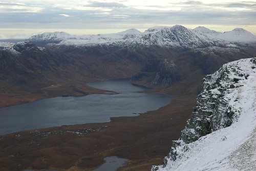
Fisherfield and Letterewe forest hills
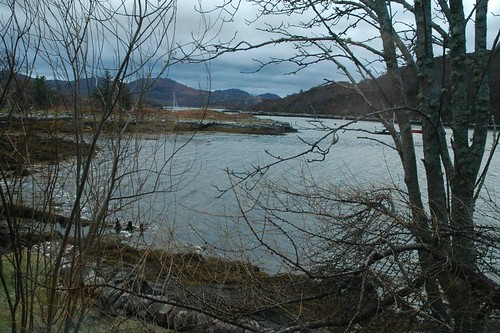
While having a late breakfast I enjoyed the view from the cabin window as some seals moved around the bay. From the cabin I crossed the floating walkway off the island and followed the shoreline around to the village.
Dry island in Badachro bay
Heading out of Badachro I found the sign for the footpath for south Erradale. It used to be an old road but today it is no more than a boggy path that is indistinct in places. It was a misty day and the near hills were just a faint silhouette when visible. From south Erradale I detoured onto the small beach at Opinan and then followed the headland around to Port Henderson.
Crossing open moorland on the way to Erradale
Thursday was another dry windy but slightly grey day. Heading north through Poolewe I followed the road round to Ardessie on the shore of Little Loch Broom. A path leads up the hillside alongside Allt Airdeasaidh and its waterfalls.
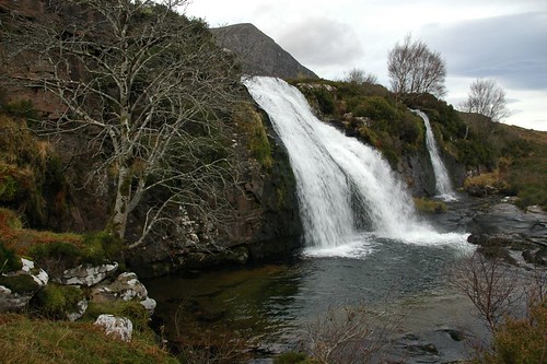
Waterfall with Sail Mhor lurking in the background
I followed the burn all the way up to Lochan Ruadh which lies within Corrie Mor An Teallach. There were mountain goats on the lower slopes and a few deer further up in the Corrie. From the lochan I moved west to the lower ridge line of Sgurr Ruadh. Travelling north my way lead over Ruigh Mheallain and then sharply up onto Sail Mhor. The top afforded hazy views out to Loch Broom the sea and the summer isles.
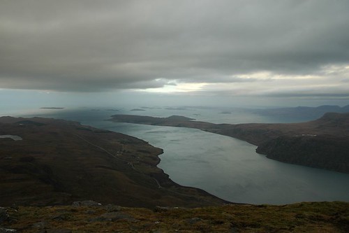
Summer Isles
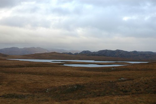
Friday would be my last day walking and I decided on a shortish route to see the "Fairy Lochs". It was a quick drive out of Badachro to Shieldaig and I left the car just opposite the Shieldaig Hotel. Following the farm track that heads all the way out to Loch a' Bhealaich on the south side of Baosobheinn, it was a short way past the last farm building before a small cairn on the left of the track singled the way up the hillside. The lochs sit at around 200m meters overlooked by another hill named Sidhean Mor, which I climbed before wandering around Lochan Sgiereach the largest of the Fairy Lochs. I imagine it would be a lovely place to be enjoyed on a spring or summer day. The loch's were the site of an air crash at the end of the second world war. An American war plane was heading home at the end of the war when it got into difficulties. It came down with the loss of all on board, much of the wreckage is still in evidence today. From here I continued slightly downhill to reach Loch Braigh Horrisdale and the main track back to Shieldaig.
Fairy Loch's
Top Of Pagesite info
© 2007-2008 Paul Sammonds. Template Design by Andreas Viklund.