Footprints Across Scotland
Why not make a few of your own!
19th to 21st May 2013
A three day backpack into the heart of Ardgour working my way around the peaks of Beinn na h-Uamha (hill of caves), Sgurr Dhomhnuill (Donald's peak), Carn na Nathrach (cairn of adders), Stob a' Bhealach an Sgriodain (peak of the pass of screes), Sgurr Ghiubhsachain (peak of the fir trees) and Sgorr Craobh a' Chaorainn (rowan tree peak).
Route Map
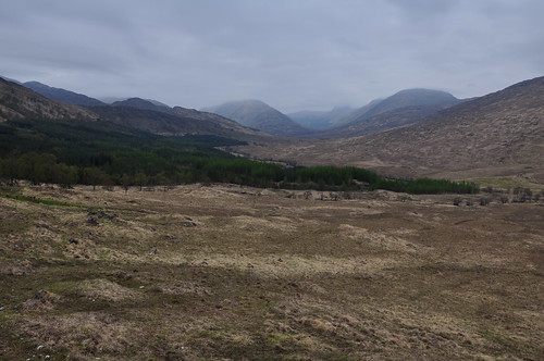
This was another walk that was put on the back burner a number of times but trips out to the area by some fellow bloggers had re-kindled my interest. After stopping at Fort William for a few extra supplies (and just as well I did) I headed down the shore of Loch Linnhe to Corran arriving to find a short queue as the ferry came in. It was then a short drive up the opposite side to Inverscaddle bay to park near the start of the estate track at Aryhoulan. After a brew and bite to eat I loaded my extra provisions and shouldered my pack ready for the long walk up Glen Scaddle. The track at the start looked like it had been re-laid and widened by what seemed a rather unnecessary amount. Further up the glen the track returned to a more worn-in appearance as it followed the tree lined river.
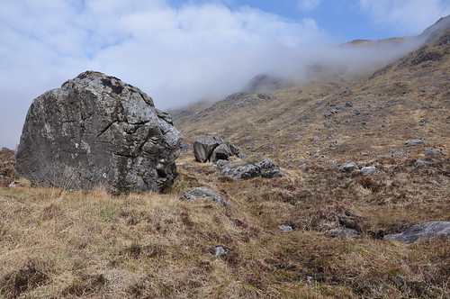
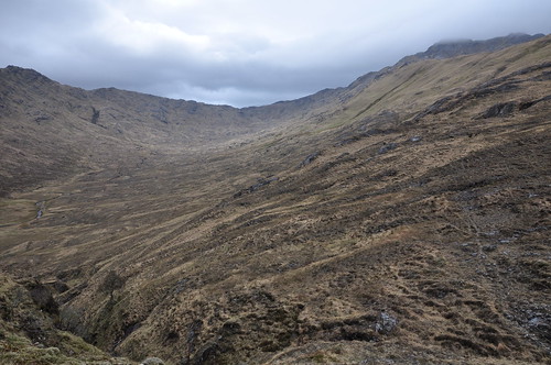
Glen Scaddle
I kept to the main track as it climbed up hill through a plantation ignoring the smaller path along the river. A break in the trees allowed me to gain an appreciation of the wild landscape I was now entering and an idea of where my first nights camp would be.
Glen Scaddle
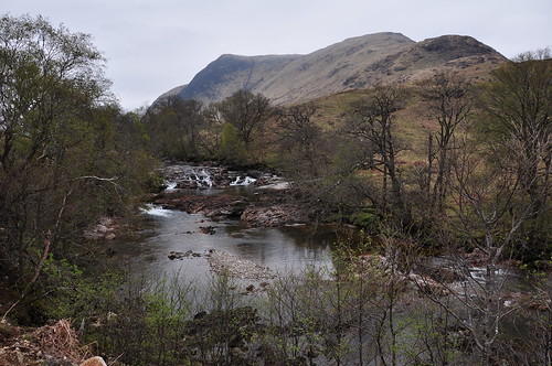
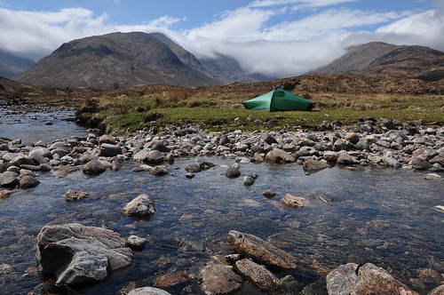
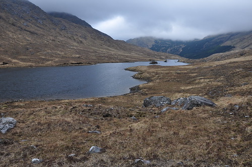
Back down at the river I forded the river Scaddle by an impressive little gorge. It wasnt too much further to the locked estate bothy at Tighnacomaire where there was a helpful note to say there was an open shelter a little way on, but this is not somewhere I would like to spend the night! Another km on at a fork in the river I found a good place to pitch the tent.
Glen Scaddle, Sgurr Dhomhnuill and Carn na Nathrach
It had taken a good four hours to get here but it was now time to head up some hills. Tent up and camping gear stowed inside I decided to brew up before heading out. This is when I discovered that Id failed to pack the meths for my stove which was a bit frustrating to say the least. Id had thoughts of keeping provisions to a minimum but had fortunately been tempted by some cold meets, rolls and pastries in fort William which would save the day and ensure Id not go hungry, although three days without tea would take some doing! Crossing the river I headed up through the trees below Meall nan Ruadhlag, then up the steep and undulating ridge to the summit of Beinn na h-Uamha.
Sgurr a' Chaorainn and Sgurr Dhomhnuill
It was a good introduction to the hills of Ardgour, tough and steep but rewarding.

Sgurr a' Chaorainn and Sgurr na h-lghinn
And as an extra bonus I was now to learn about the realities of linking a couple of these peaks together, lots of up and down! Beinn na h-Uamha is twinned with Sgurr a Chaorain, with just a metre between heights they are separated over a couple of km by a col with a drop of about 100m.
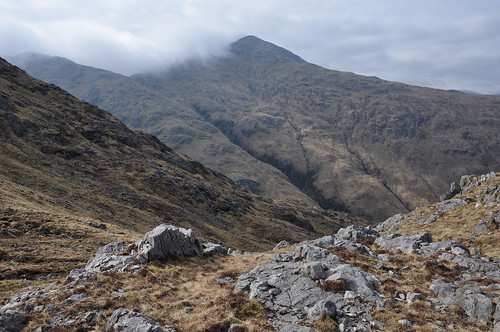
Sgurr Dhomhnuill from col below Sgurr a' Chaorainn
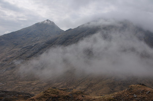
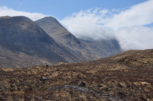
There was a band of mist forming which was threatening to wash over the summits I was now heading toward. Indeed as I worked down through the crags to the high bealach that separates Sgurr a Chaorain and Sgurr na h-lghinn I was engulfed by the grey dampness and required my compass to keep me right. The way onto the next peak wasnt obvious but I worked upward and into a narrowing grass chute. Figuring that this was a fairly pointed peak any line upward would take me to the top. Having reached the cairn I realigned myself with compass and now headed for the summit. Another cairn was reached but a bit to quickly and limited views through the mist on compass bearing didnt tie up with the map. I realised I was on a small knoll south of the summit so continued onward. The ground then steepend into the gloom which reassured me that I was on track. The next cairn was much more substantial and more fitting for what is the highest peak in Ardgour, Sgurr Dhomhnuill. The line drawn by the mist seemed to be held back by the row of peaks Id just climbed and it toed and froed occasional revealing my surrounds and helpfully my route off to Glen Scaddle to the east.
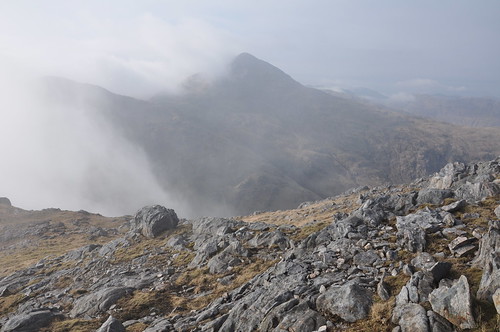
Sgurr a' Chaorainn from Sgurr Dhomhnuill
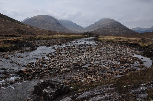
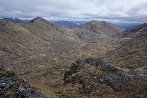
Getting onto to the ridge that leads to Sail a' Bhuirdh was now less of a problem, I dropped east from the summit before turning south to pick up the broad finger pointing my way to camp. Once in Gleann na Cloiche Sgoilte I forded the low river to pick up the path leading to my tent.
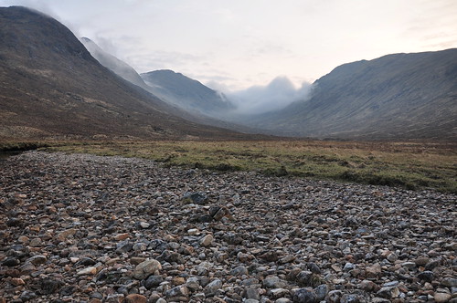
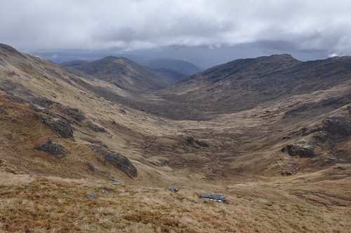
Gleann an Lochain Duibh
Looking back the mist was still spilling over into the upper reaches of the glen without actually advancing down it. It was sandwiches for dinner rather than Green Thai curry! Which was a shame but feeling hungry I was more than happy with the Italian meat selection and some cheese, although a coffee to finish would have been nice. The following day dawned brighter than the previous with promise of a good day. The mist from the previous day still loomed over the higher peaks to the west and I hoped it cleared before I headed for the tops.
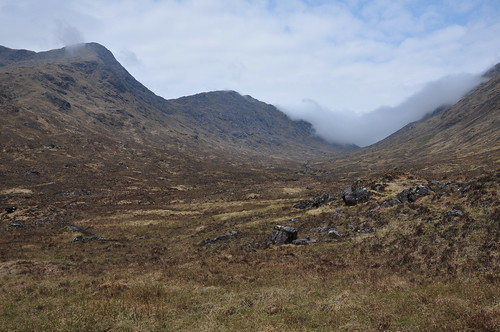
Gleann an Lochain Duibh
I had toyed with plans for the day but decided to leave the tent in place while I visited Carn na Nathrach. The pathway soon disappeared as I worked my way up Gleann na Cloiche Sgoilte. A few deer seemed a little surprised to see me but were not overly worried as they sauntered away.

Stag in Gleann an Lochain Duibh
Eratic below Sgurr na Nathrach
Gaining height gradually I passed a fine water chute before entering the bowl at the head of the glen.
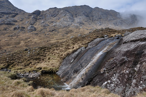
Water chute
The ground here was pretty boggy but some careful manoeuvring meant I avoided too much of a sinking feeling as I made for the bealach. From here I aimed up to gain the col to the west of the summit.
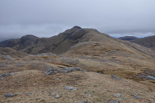
Sgurr Dhomhnuill
I now had a fine overview of my next set of hills that lay to the north but first I needed to complete my climb to the top of Carn na Nathrach.
Stob a' Bhealach an Sgriodain and Meall Mor
It was now very pleasant and I took it all in while enjoying a snack at the summit. The mist was still brushing the pointy top of Sgurr Dhomhnuill. Another long finger of ridge would this time lead more gently to the glen below. A number of lizards showed off their agility and speed of movement over the straw like grasses. I almost stumbled upon an Adder sunbathing on open ground, it was a little way from any cover so I managed to get a few photos, despite the hissing and pulling of tongues.
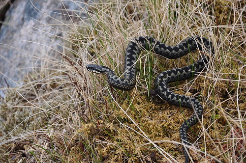
Adder on Carn na Nathrach
I soon left it in peace while reflecting on the fact that I had come across it on a hill whose Gaelic name translates as cairn of adders.
Sgurr Dhomhnuill
Back at river I enjoyed another bite to eat while watching wagtails and sand piper work the river banks all to the sound of cuckoos in the background. It was just lovely sitting there soaking up the sunshine and the wonderful surroundings. It would have been a very pleasant way to idle away the afternoon; it was a real effort to stir myself into action and pack up camp.
Camp at the entrance to Gleann na Cloiche Sgoilite
Crossing the river by the footbridge I headed into Gleann an Lochainn Duibh passing the waterfalls at its entrance.
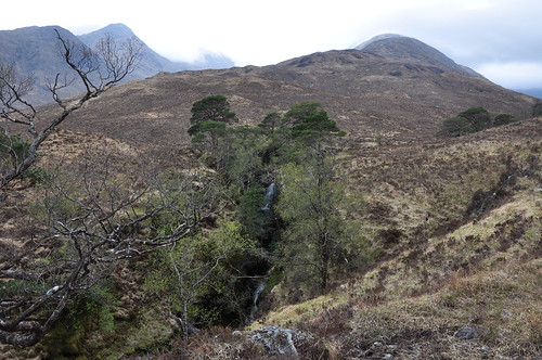
Waterfall below Carn na Nathrach
The path came and went on the way to Lochan Dubh at the head of what is another fine glen.
Lochan Dubh
The slopes of Stob a Chuir were strewn with a jumble of boulders which I worked through before beginning a rise up familiarly steep slopes to gain another high bealach. I began looking for a place to camp while taking on the south east ridge of Meall Mor and eventually settled on a spot behind the upper crags which gave some respite from the strengthening wind. I had grandstand views of Carn na Nathrach and Sgur Dhomhnuill beyond.
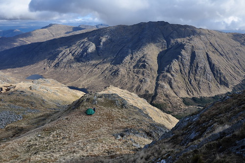
Camp on Meall Mor
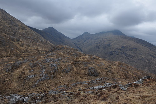
After a comfortable night I prepared myself for another tough day but at least I had a good high starting point. Mist was skirting the tops again but lifted as I approached Stob a' Bhealach an Sgriodain over an undulating ridgeline.
Bealach an Sgriodain and the ridge round to Meall nan Creag Leac
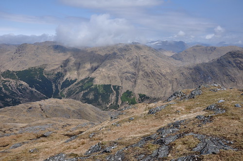
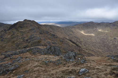
The route from here follows a wide circuit of upper Cona Glen around to my next objective, Sgurr Ghiubhsachain. At Bealach an Sgriodain I was in need of water so dropped off the ridgeline to replenish my bottles. There were some fine rock formations to be admired along Druim Tarsuinn which leads down to Bealach Scamodale above Coire an t-Searraich. A slight drizzle increased to something heavier so I donned waterproofs before the climb upto Meall nan Creag Leac.
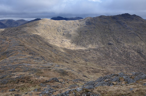
Meall nan Creag Leac and Sgurr Ghiubhsachain
From here there are fine views up and down Loch Shiel. This was originally going to be, and would have been, a possible campsite for my second night.
Sgurr Craobh a' Chaorainn and Cona Glen
Cona Glen

Loch Shiel and Sgurr Ghiubhsachain
The ridge now narrowed before rising over more rocky knolls to reach the stony summit of Sgurr Ghiubhsachain. I was enjoying lunch looking into Cona Glen and considering the route across to Sgorr Craobh a' Chaorainn when I was very much surprised to here a voice behind me. The guy was staying in Glenfinnan having taken the train up from down south, he was the first walker Id seen in nearly three days. From the summit I returned south west along the ridge for a couple of hundred metres to pick up a grassy shelf that led me under and around the upper crags. The ridge broadened on my way over to Sgorr Craobh a' Chaorainn while behind the mist descended to cloak Sgurr Ghiubhsachain.
Sgorr Craobh a' Chaorainn
A steady climb was greeted with a slight sting in the tail as I approached the next top being presented with a sheer rock wall. However turning the knoll on the right an easy scramble up rocky slopes soon lead to the top. After a short stop I retraced my steps to the foot of the rock wall before dropping into the glen that leads out to Callop. Again there was some lovely patterned rock as I neared the path at the glen floor.
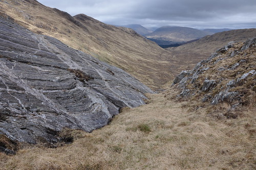
Rock Strata
View back up to Bealach Scamodale
As I headed into Cona Glen I could see that there was some reforesting work going on, which may have explained, but not totally excused, the work on the track leading out of the glen. It formed a wide grey scar for miles into the distance. The surface was soft and my trail shoes appeared like footprints in wet cement! The track eventually returned to something a little less unsightly some way further on.

Cona River
Its a very long walk out but as I approached Corrlarach my mood was lifted by the sight of a couple of cuckoos.

Five shades of Horse in Cona Glen
Near Doire Driseach I took a track down toward the water and enjoyed the fine riverside walk back to the bridge over the confluence of the Cona and Scaddle rivers. Back at the van it was time to take off shoes, air the feet and get a most welcome brew on.
Top Of Page
site info
© 2007-2008 Paul Sammonds. Template Design by Andreas Viklund.